Rivers and Lakes in California
Rivers and lakes in California are some of the best waterways in the country. We'd like to take you there!
Let's find some of the best, some of the most fun, and some of the unique. Even some of the unknown/untold - we've found them out! All a treat for those of us who love visiting rivers and lakes in the Southwestern United States!
Scroll to Peruse OR Click Your Choice:
With purchases made via links on our site, we may earn a small commission at no extra cost to you. Details at our Advertising Policy.
Type in Your Search Word
Which Rivers and Lakes in California
Strike Your Interest?
California Rivers
We'll take a ride, roaming back and forth across the state, and heading North to South. Let's see the rivers we come across. It should be an interesting trip!
You'll notice the more southerly we travel, the fewer are the rivers, sometimes the less pristine.
With more population growth competing for river resources, & increased drought effects the further south we travel, there seems a connection. It's why we all must do our part to take care of our rivers and lakes in California, and really: everywhere! Don't you think so?
 Rivers Refresh the Heart & Mind
Northern California Rivers
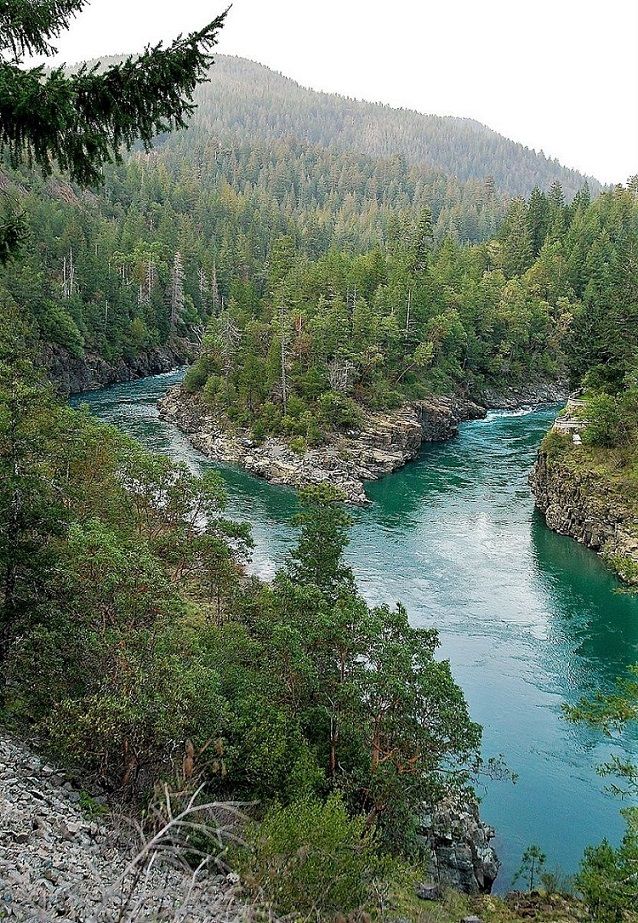
SMITH RIVER - Headwaters at North Fork, West of Oregon's Chetco Divide, a wild/scenic river. While the South Fork's wild/scenic river starts West of Bear Mountain in Six Rivers National Forest. The Forks' confluence at the village of Hiouchi. Then travels North-Northwest until Pacific Ocean outlets south of Smith River. So much to see & do along this wonderful river! For instance:
- Drive Smith River Scenic Byway: 35 miles.
- Begin Hwy. 101/199 Junction, take 199.
- For the sights: 4 miles of redwoods, Hiouchi Bridge, MP6.55: the Forks, MP7.2/South Fork Rd. (turn there for side-trip over 2 bridges, viewing Middle & South Forks) for Myrtle Beach.
- Use turn-outs from MP8.2-10.5 for views of amazing rapids plunging down canyons. End at Oregon.
- CCC 1930s walkway from Camp Gasquet, viewing adjacent rock walls. After picnicking by the river, a short interpretive walk leads to Lodge. Take Hwy. 199E just over 7 miles to (tributary) Patrick Creek Campground to start.
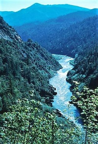
KLAMATH RIVER - This amazing river is sourced up in Oregon at a huge watershed feeding Upper Klamath Lake.2 Winding its way southward into California north of Beswick. Then turns westward, with Copco & Iron Gate Lakes impounded. The Trinity River merges at Weitchpec. It flows Northwesterly, til the Pacific mouth at Requa. Facts to Know:3
- From below Iron Gate Reservoir's dam in California, has state/federal Wild & Scenic River status.
- Also major tributaries: Scott & Salmon Rivers, plus Wooley Creek. All have state/federal Wild/Scenic designation
APPLEGATE RIVER - A prime tributary to Oregon's Rogue enters California in remote Rogue River-Siskiyou National Forest. Headwater springs at Siskiyou Crest summit.4
- Vistas & trailheads abound, like camping at Horse Camp near Cook & Green Creek tributary.
- Scenic riverside driving South from Oregon's border along FS Rd.1040. Keep going on FS road to the hairpin turn, for the Middle Fork trail.
- Keep on the road to FS Rd.1035 for Whiskey Ridge Viewpoint - amazing!
FEATHER RIVER - Tributary of the Sacramento River, other tributaries are its own Forks: South, Middle & West Branch.
Almost 78 miles of the Middle Fork federally designated Wild/Scenic/Recreational River. That's nearly the entire fork.
The Middle's headwaters near Beckwourth amidst marshland & springs surrounded by Tahoe National Forest.9
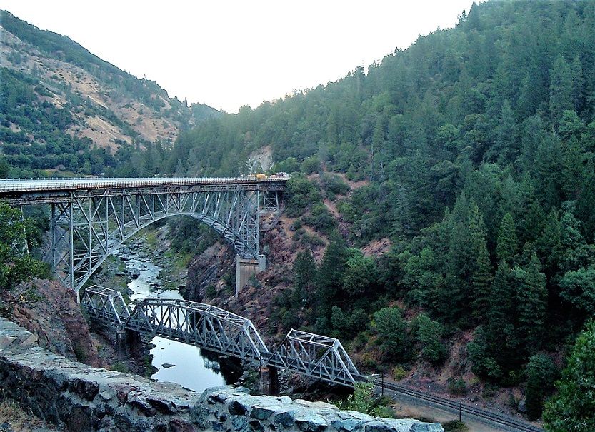
A Fantastic Drive is Plumas County's Feather River Canyon. Take Rt.70 (Feather River Hwy.) from Oroville to Quincy.13 You'll cross Lake Oroville, soon following the North Fork. Many stopping points to love along the way!
PIT RIVER - Did you know it's the longest Northeastern California river? Plus the longest tributary of the Sacramento River.
What a wild ride! From headwaters at Nevada's border flowing through canyons, towns & forests, tumbling through waterfalls. Trout Fishing spots along the way.5
Lots more recreation from Lake Britton & several Pitt Reservoirs. Final destination: Lake Shasta.
Central California Rivers
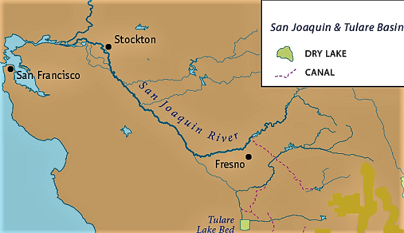
SAN JOAQUIN RIVER - Another huge babbling, rushing & rambling trek for this Sacramento's tributary. Has its own significant tributaries: Merced, Tuolumne & Stanislaus Rivers.
Headwaters up the eastern Sierra-Nevada,8 near Thousand Island & Garnet Lakes. Cascading into the Central Valley, turning north toward Stockton.
Several dams create lakes (Redinger Lake) /reservoirs (Mammoth Pool). Opportune flood control & water distribution, but Dams Can Be Harmful to native species, etc. Currently SJRRP works repairing river flows to return self-propagating species of native fish, like salmon, to its waters.
RUSSIAN RIVER - Running South, east of coastal ranges.
First called by tribal name: Ashokawna, meaning East Water Place.6 Current name from 1800s Russian explorer Kuskov.7
Headwaters in lower Northern California, the hills east of Willits. Plenty of wineries en-route, & many creek tributaries. Advancing through towns like Ukiah, where its East Fork involves a Fish Hatchery & Lake Mendocino.
Hwy. 101 often follows its course, offering varied picnicking parks (Cloverdale) or swimming at Steelhead Beach Regional Park in Forestville. Journeying by, you'll note campgrounds. Ruggedly nice ones at Pacific's outlet in Sonoma Coast State Park. Can't beat that beach!
NAPA RIVER - Headwaters at Mount St. Helena, running south/south-west through Napa wine country.
Many tributaries assist its 50+ mile trip to outflows at San Pablo Bay's Wildlife Refuge. Its waters also make up Lake Hennessey, Lake Milliken & Bell Canyon Reservoir.
Area residents concerned with pressures on its pure survival, formed a Friends Group.
 A Beautiful Napa Riverside Walkway Brings You to Cafes & Other Sights
Even Explains the River's History
KINGS RIVER - Headwaters in Kings Canyon National Park, eastern Sierra-Nevada.
South Fork at Lake 11599, & Middle Fork at unnamed glacial lake South of Helen Lake. Their confluence forms the Kings. The Forks & 6 miles afterward designated Wild and Scenic River.
But all along its flow, plenty of scenic thrills & recreation. For instance Pine Flat Lake. And fantastic fly fishing, River Rafting (think rapids) & much more.9
It ends feeding many sloughs & irrigation canals in the Tulare Lake Basin's Central Valley.5
SALINAS RIVER10 - Headwaters in San Luis Obispo County's Garcia Mountains. Nicknamed "Upside-down River" because...
- It Flows Northwest. Finally arriving to Wildlife Refuge in Monterey Bay
- Subsurface Flow. Tremendous amounts, among the most in the U.S.
- Facing many troublesome times. Source of water for agriculture, military & cities. Yet local wildlife & groundwater recharge compete for its resources. Located in Paso Robles Groundwater Basin which faces drought conditions, increased populations, pollution, etc. Individual ecological projects exist, but not yet a cooperative watershed management plan.
- Saving graces along its way: San Lorenzo County Park, Big Sandy Wildlife Area.
Southern California Rivers
KERN RIVER - Headwaters between Caltech Peak & Mt.Ericsson, in Sierra-Nevada's Sequoia-Kings Canyon Wilderness. Soon flows through a glacial lake, the Upper Kern begins rushing downhill. South Fork headwaters about 10,000' in Golden Trout Wilderness. Crosses FR22S05 & adjacent to Pacific Crest Trail.
- Upper 151 miles between both are designated Wild/Scenic rivers.9 Teeming with fabulous recreation of all kinds. Access everything from Bakersfield.
- We spent a terrific week in a Kernville rental. All kinds things to do: every type of camping, trails, rafting, tubing.

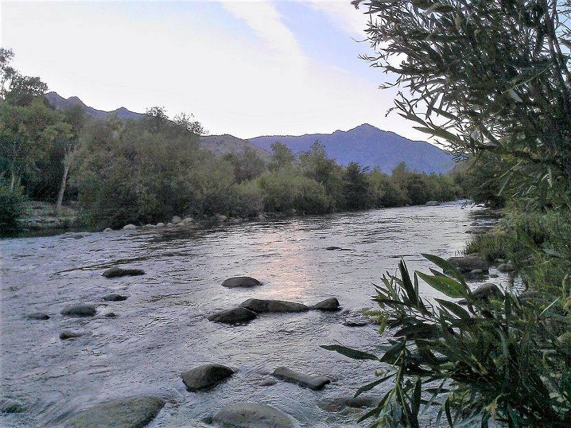 We Stayed at an Inn Alongside this Spot on the Kern River
Once in a While People Tubing Floated By!
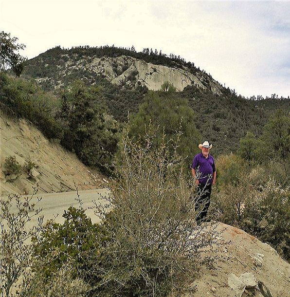 We Explored the Sequoia National Forest Area Surrounding the Kern River
SANTA CLARA RIVER - Headwaters in Angeles National Forest, San Gabriel Mountains north slope. 84 miles long til outflow at McGrath State Beach's lagoon/estuary.
An important tributary, Sespe Creek, has Wild Trout Stream designation.11
Lower river section pressured by population growth & conversion of land usage from the natural state. Yet it's one of few remaining Southern California mostly "au-natural" rivers. The Nature Conservancy is its prime protector, Getting Cooperation from farmers, etc.
SAN GABRIEL RIVER - Short, but valuable San Gabriel Mountains' river in Los Angeles County. Just over 25 miles, in three forks.
Several endangered species live in its environs. Just one reason to keep its ecology solid.
People invited for wise use by camping, fishing, swimming & hiking the Gabrieleno National Recreation Trail, paralleling the upper West Fork.3
Cogswell Reservoir affected by Bobcat Fire, undergoing Sediment work & revegetation.
SAN DIEGO RIVER - Beginning in San Diego's East County mountains, from Ironside Spring. Traveling over 50 miles to the ocean via Mission Bay.
It begins as Santa Ysabel Creek, flowing into Sutherland Reservoir, then the River's Gorge near Eagle Peak Preserve.12 Many small stream tributaries important, especially Boulder & Cedar Creeks. Many areas hide subsurface flow.
Lakes in California
You may have noticed, nearly all the rivers above helped create, or interacted with lakes in California. Yes, rivers and lakes in California do go together! You normally don't have one without the other.
And there certainly are many Beautiful Lakes in California!
Lakes usually result from river flow. Some naturally, but also created by humans. Even sometimes, from animals, like beavers!
Since we just finished up our road trip in Southern California, let's go from there, traveling north.
Lakes in Southern California
Salton Sea
Has to be one of the most unique lake-like features in the U.S. We've "circled" it twice, each time discovering something else weird or maybe just out of the ordinary.
Somebody described it as a beautiful disaster, as if living out Fallout, the video game.
- Archeology shows the lake has ancient history, intermittently drying up, most recently around 1700.14
- Sea filled again early 1900s. From Colorado River water interacting with irrigation.15
- Three floods upstream over the 1905 winter, led to downstream rising 100 feet. Overflowing into main irrigation canal & subsequently into lowest desert areas through other irrigation ditches.
- Subsequent floods added more flow. Water circled around creating the Alamo & New River channels. Water filled into old lake bed & flooded the New Liverpool Salt Company.

- Even waterfalls resulted from rushing water! Mexicali & nearby Calexico suffered heavy flood damage.
- It continued filling until finally Engineering solved it in February 1907. Eventually stabilized, forming what still today is this Salton Sea.
- Summing up, amazingly it was "a rush of 360,000,000 cu.ft of water per hour, down a four-hundred-foot slope of easily eroded silt, into a basin big enough to hold Long Island Sound."
Lake Arrowhead
PRIVATE LAKE ACCESS16 - Sort-of ways around that. If you stay as a guest, then you'll have options. Other things to do: book a ride on the Arrowhead Queen, or take lessons at McKenzie Water Ski School.
Otherwise Lake Arrowhead's town is a resort destination. Plus public events, about every month. Like kids' Easter Egg Hunt, Boat Shows, July Fireworks, Oktoberfest & Holiday Festivities.
- Nearby is Lake Gregory Regional Park - In Crestline. 84 water-acres for swimming, fishing, boating, hiking. $10 day pass.
- Heap's Peak Arboretum - Hwy.18 near Skyforest. Free entry with Adventure or similar Pass, interpretive botanical garden, picnicking.
Lakes in Central California
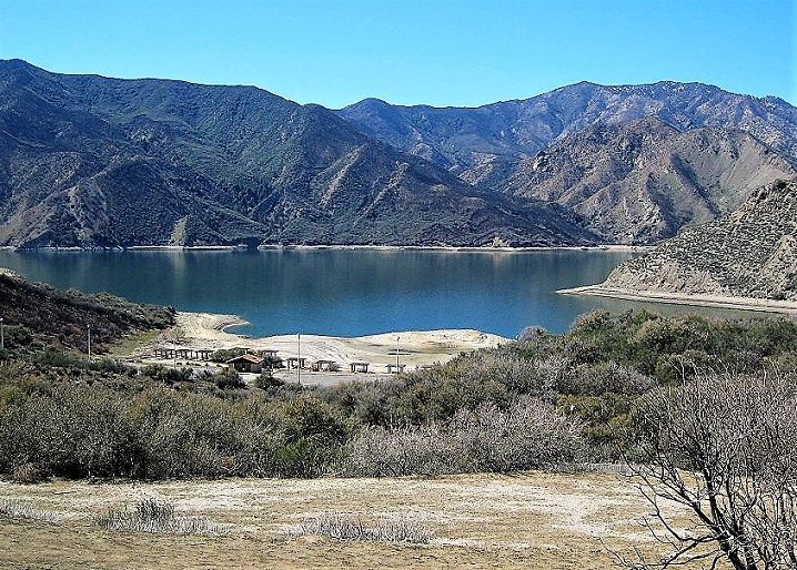
Pyramid Lake
All the water play is here!
The named-for rock formation was artificially created, as was the lake. Hwy. 93 construction resulted in a pyramid shaped rock. Damming of Piru Creek formed the lake.18
Boating of all types, observe speed limits please.
- Emigrant Landing's marina for rentals & multi-lane ramp, take I-5 Exit 195
- Vaquero Beach has nonmotorized launching, take I-5 Exit 191
Fishing anywhere for many species: bass, trout, panfish & more. Emigrant Gap is accessible.
Vaquero Beach is your place to swim with its sandy shore & picnic areas. But plenty more picnic spots all around Pyramid Lake.
661-944-8740 any other details.18
Avacado Lake
A Fresno County Park surrounds this Piedra lake. Possibly an Oxbow type17 adjacent to Kings River.
$5 parking fee (returning much? Get year's pass: $40). Opens 7am. Closes 7pm winter, but not til 10pm summertime.
Lake has dirt launch ramp, fishing, swimming, picnicking.19
Directions Out of Fresno: Hwy. 180E (Ventura Rd.), about 17 miles left on N.Piedra Rd. 5+ miles to park's left entrance.
Lakes in California's North
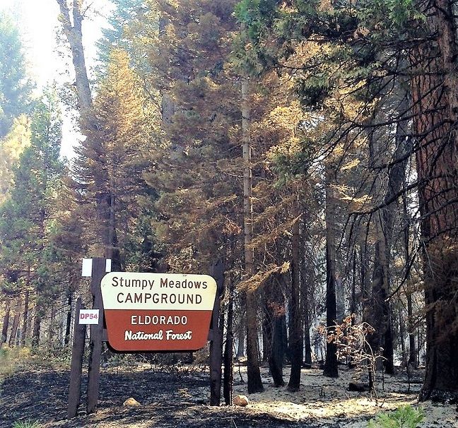
Stumpy Meadows Lake
Originally called Lake Edson. When open: June to October, great place for camping, fishing (winter if you can get there!), & boating (motorized okay - no water-skis: 5mph speed limit). Just over 4000' up.19
Camping: check into Stumpy Meadows when opened
- Suitable for tents or RVs
- Water & restrooms available. $10 for dump station at Ponderosa Cove Group site overflow
- Can gather dead/downed wood for fires, when campfires allowed - within fire ring
Hike the Edson Burn Interpretive Trail
Even swimming's A-OK! But recommend Water-Shoes with rocky beach/lake bottom. Water temp nice in summer.
Fishing with license. How about Trout Fishing? It's stocked.
Directions: From I-80, Exit 119B to Hwy. 49E/193-Golden Chain Hwy. In Cool take 193 toward Georgetown. Reaching Georgetown's center, go left on Main St., turns into Wentworth Springs Rd. Follow all the way!
Sly Creek Reservoir
Pristine man-made lake east of Oroville, in Plumas National Forest. Two adjacent campsites, concession-operated April/May-Oct., first-come/first-served. Tents or RVs up to 40' long. Swimming OK. 530-534-6500
- Strawberry CG - 17 large, heavily tree surrounded sites, with picnic table & fire ring/grill. Water (some say yucky taste for drinking) & restroom available.
- Sly Creek CG - 25 Sites surrounded lightly by pines, with picnic table & fire ring/grill.
- Boat launch ramp near dam. Motorized, waterskiing allowed. Observe posted speeds. Nonmotorized.
- Fishing, fish-cleaning stations.
- Swimming allowed, sandy beach areas available.
See References For Rivers & Lakes in Cali>
Some Directional Information on This Page May be sourced from Map data ©Google
