Lakes in New Mexico
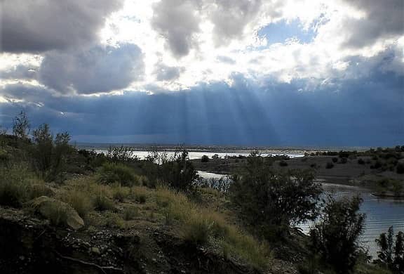
Lakes in New Mexico are stunningly situated through mountains and desert in this beautiful state. It's the "Land of Enchantment" after all. And you can spend enchanting hours and days at a lakeside in New Mexico, enjoying wonderful times.
Often, lakes are created from river or stream sources. There are several river sources in New Mexico.
With purchases made via links on our site, we may earn a small commission at no extra cost to you. Details at our Advertising Policy.
Yes, New Mexico has a lot of desert areas, causing some to wonder, are there any lakes in New Mexico? And if there are, they wonder how many New Mexico lakes are there?
Some Major Lakes in New Mexico result from dams in the well-known Rio Grande River, which flows throughout the state, from North to South. The Pecos River, Canadian River and San Juan River are major sources for New Mexico lakes.
Of course there are many tributaries, smaller streams and creeks which flow into these rivers. Plus a few other rivers with less New Mexico flow miles. But they influence local water tables and lakes.
There are also some unique waters, like the famed bottomless lakes of New Mexico.
We'll eventually be traveling to all of the above.
So scroll on down to view all we've got. Or you can designate, by clicking to start with...
THE LAKES ALONG THE FAMED RIO GRANDE RIVER:
OR ALONG OTHER NEW MEXICO RIVERS:
Lakes of the Rio Grande
New Mexico's Major River
We've traveled lots of this route, mainly from south of Albuquerque. A little bit north of there, too. We're continuing to travel more of that!
You'd discover wonderful places for birding: wetland sanctuaries which often have Hidden Lakes along their pathways. Then there are large lakes with pretty good facilities. They're fairly long and relatively narrow. Quite scenic, backed by stark desert mountainsides. And a couple of the best boating lakes in New Mexico.
The farther north you go, the more lakeside vegetation there is, as the elevation climbs.
Rio Grande Lakes in New Mexico
LAKES SOUTH OF ALBUQUERQUE
All easily accessed from I-25.
Valle de Oro Urban Wildlife Refuge - Adjacent to the river, recently improved, more updates continue. The river's bosque is created around the storm-water swale and playa wetland.
- Lush greenery amidst waters attracts migrating & nesting birds to this urban oasis.
- Multi-use & hiking only trails, & Visitor Center. Update email: valledeoro@fws.gov
Isleta Lakes - On the property of, managed by Isleta Pueblo Native American Tribe. Thus they're private lakes.
- They feature an RV Park, playground, picnic areas
- RV Park provides site grills & full hook-ups, free Wi-Fi, showers, laundry, store. DirectTV available. Good Sam Discount.
- Two trout/catfish stocked fishing lakes, with tribally purchased license (even a discount Frequent-Fishing card).
- Plus a shuttle bus to their casino & all their amenities. 505-724-3800
Sevilleta National Wildlife Refuge - Tons of Land Here, the River runs through it. Affording opportunity to flood area for lakes/wetlands.

Socorro Nature Area - BLM managed: take I-25 Exit 156/Lemitar to go East. Continue straight as it becomes Rt.408 until it ends over railroad tracks, then right on Schmittle Rd. 0.2 miles to left on Nature Lane.
- This area will be involved in the Rio Grande Trail that's to traverse the Entire State.
- Make the 1/2 mile interpretive hike by the pond and the bosque.
- Picnicking area, birding, nicer in winter if you're not prepared for some heat.
- Call ahead to be sure it's open: 575-835-8927
Escondida Lake - In Socorro. Adjacent to the city's Escondida Bridge Park, which also offers a campground with full hook-ups.
- Lake is small, primarily for relaxing near viewing the scenery, or some fishing.
- From I-25 Exit 156/Lemitar, go East, then turn South on Rt.408. Left on Pueblitos Rd., (straight on for the bridge park) left on Staton Rd.
Socorro is a Centrally located place to stay to visit a number of lakes related to New Mexico's Rio Grande. We've been to the area several times, visiting the Array, nearby birding areas, etc.
Here's What We Feel is One of the Best>
- Bosque Del Apache - A National Wildlife Refuge with over 53,000 acres. It was created to return the area to its natural wetlands flood process.
 Migrating Geese Love This Stopover at Bosque del Apache National Wildlife Refuge!
- Try the Auto Tour Loop taking you by wetlands that bird enthusiasts love! It's also scenic.
- Recommended visit timing of 45 minutes minimum. But why not stop at the overlooks, etc. & take around two hours of enjoyment.
- There's plenty here for hikers, too. Ten trails for all levels.
- An easy trail traverses 1/2 mile boardwalk over wetlands.
- Still another visits an Observation Blind.
- Plus tracks recommended for bicycling, particularly the Low Flow Conveyance Channel East Service Road.
- Especially famed for autumn's Sandhill Crane Festival. Don't Miss It!
Elephant Butte Reservoir - The state's largest lake, at 2,065,010 surface acres if/when full. Many activities to be had here, including boating, fishing, camping, swimming & even scuba diving!
- Elephant Butte Lake State Park - Three Campgrounds with electric/water & dump station, plus many more primitive sites available.
- Sandy swimming beaches along the shores.
- Trails, picnicking, marinas, boat ramps.
- Accessed from I-25 Exit 89 or 83. More info: 575-744-5421
Mimms Lake - This oxbow lake, historically sectioned off from flows of the Rio Grande, able to hold 91 surface acres.1
- With drought effects, the lake's waters kind of get sucked up when nearby areas source diminishing groundwater.2
- Its prior use has been for fishing, but now apparently is surrounded by private property.3
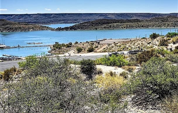
Caballo Lake - Many lake water activities for fun days. While smaller that Elephant Butte down the road, it's also not so built-up.
It's calmer. The waters, even without drought circumstances, are more shallow overall.
Best access is via the park.
Caballo Lake State Park - Swimming, fishing, boating (all types), & hiking.
- Camp sites for RVs have utilities & dump station. Plus boat-in & group sites.
- Gardens, picnicking, birding.
- Trails for hiking, horseback (after all, named for horses!), learning interpretation.
- So much more! We think you'll enjoy this place. We did!
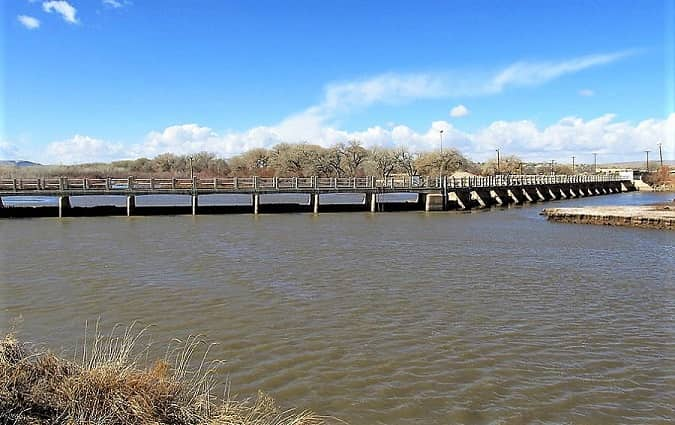
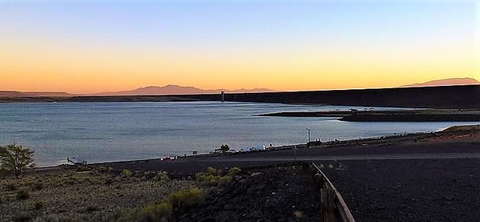
Leasburg Dam Backwaters - With optimal Southwestern Climatology, waters held back here were available to distribute to area farms. Its purpose when constructed as a diversion dam in 1907.4
In drought conditions, not so much. To observe post-dam results, get to the park:
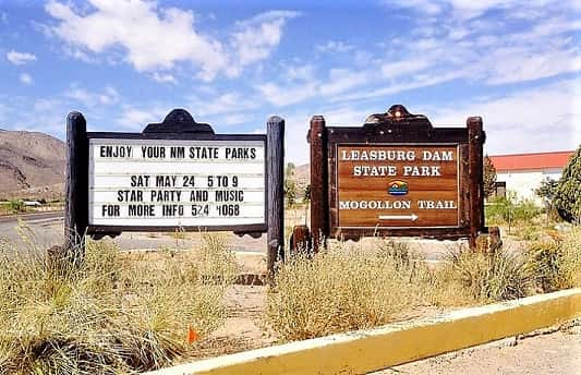
Leasburg Dam State Park - RV sites with elec/water (16), 2 more specifically set-up as accessible. More developed basic sites have nearby water access. Must make a reservation.
- Restrooms have showers.
- Activities: Visitor center museum, hiking, playground, birding, Interpretive Garden, Once-a-month Observatory Night-Sky Event, access to Historic Site.
- In 2017, upgrades were made5
- When the Rio-Grande flows: swimming, boating & fishing. 575-524-4068
NM LAKES OF ALBUQUERQUE & NORTH
Easily accessed from I-25, or relatively so.
ABQ BIOPARK & JAPANESE GARDEN PONDS6 - What a wonderful city park. Lots to explore, so be sure to reserve the whole day.
From I-25, Exit at 226B, merge onto I-40W to Exit 15A. Turn left onto Rio Grande Blvd., right at Central, left at Tingley Dr. to parking.
- Tingley Beach - Free Entry: Central Pond, Children's Pond (for kids to 12 years) & Bob Gerding Catch/Release Pond have fishing (buy your license right there) & model-boat sailing.
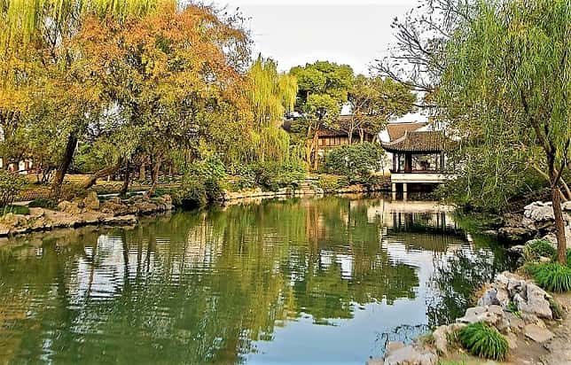
- Japanese Garden - You'll feel yourself relaxing when arriving at this particularly serene spot. Entry included with Botanic Garden. In 4 acres it includes a wondrous koi pond refreshed with a waterfall. You can inquire about a Docent-Led tour.
JEMEZ CANYON RESERVOIR - Within Santa Ana Pueblo native lands. Its purpose is Jemez Creek sedimentation & flood control.
No direct access to the lake.
- There was picnicking at a Day-Use overlook with covered tables & grills.7,8 But it's been recently closed.
- Now the U.S. Army Corps of Engineers will be turning over control of the area to the Tribal Management.
- You can read more about the situation here:
SHADY LAKES - If you like to find Fishing Lakes in New Mexico, think of this place.
A private, seasonal lake just north of Albuquerque. Trout, bass & bluegill stocked for paying the fee that includes your license.
- Contact: shadylakesfishing@gmail.com
THIS FACILITY IS NOW CLOSED - THE OWNERS CLOSED IT "PERMANENTLY." WILL SOMEONE ELSE COME ALONG TO REOPEN IT? WE DON'T KNOW RIGHT NOW. WE'LL KEEP CHECKING!
CONCHITI LAKE9 - Within the Pueblo de Cochiti Nation, fully no-wake throughout.
Rio Grande River was dammed for this flood management project. But recreational benefits are appreciated in this high desert, 5300+' elevation.
Two Recreation Areas managed by the Army Corps of Engineers. Fishing, playground, picnicking & swimming.
- Cochiti Rec Area - West side, with boat ramp, scenic overlook, open year-round. Campground seasonally Reservable. Sites with variable utility options.
- Tetilla Peak Rec Area - East side, with boat launch, overlook. Seasonal: April 15-Oct. 15.
Not Into Camping? But would like to spend some time at the lake - there are a few options.
Stay in Bernalilo, North of Albuquerque, so you can double up on seeing the city.
That's about 40 minutes easy driving to the lake.
-----------------------------------------
Or maybe even better, how about seeing Santa Fe also?
A few Nice Stays are SW of Town, about 1/2 hour drive to Cochitia Lake in New Mexico.
Lakes in New Mexico Along the Pecos River
Beginning in the Sangre de Cristo Mountains in NE New Mexico. From there to Terrero, that's 25-1/2 miles designated National Wild & Scenic.
Along its way to the Texas border where the Pecos Continues, its created numerous lakes in New Mexico.
In some nearby areas, its watershed also references other lakes, perhaps relating to groundwater shared by both. The renowned Bottomless Lakes are an example.
The Pecos has historically meandered, and during flooding, created oxbow lakes, still seen today.12 Let's go find New Mexico lakes on its course.
COWLES PONDS - Two small fishing lakes adjacent to the Pecos River, within its canyon, just south of confluence of two creeks forming its headwaters.
- Influenced by riverine groundwaters. Vault toilet/garbage bin at nearby trailhead. Bring your own water.
- Small pond for kids age 12/under, & disabled. Larger one for adults with fishing license. Latest stocking info: 505-757-6360
- Take Hwy.63N out of Pecos 20 miles, then left on FR121 to left entry.
MONASTERY LAKE - Adjacent to the Pecos River & grounds of Our Lady of Guadalupe Abbey. They have rentals available for a Peaceful Retreat in this beautiful area.
SANTA ROSA LAKE - The first major New Mexico lake formed with Pecos River waters. Some Day-Use areas on the lake are free, managed by the Corps of Engineers. Best access for longer term is with state parks:
Santa Rosa Lake State Park - All recreational fun for you here.
- Every kind of boating, from motorized to personal watercraft.
- Trails, including equestrian.
- Fishing, birding, picnicking, swimming.
- Camping with ADA approved sites, RV hook-ups, Dump-station, reservable, all the way to primitive. 575-472-3110
LAKE SUMNER - With 4500 surface acres, created by the Pecos River's Sumner Dam. Named for Fort Sumner, 15 miles southwest of this New Mexico lake.
An area with several Pecos River related New Mexico lakes and ponds. You can try exploring several dirt/gravel back-roads on the northwest & eastern side of the lake for access.10
There's also private homes adjacent to parklands on the southeastern shores. But if you don't want to stay in a campground, there's This Choice up a little over 30 miles up the road near the Blue Hole in Santa Rosa.
Where you'll find easiest lake access, for all kinds of recreation: the state park.
Sumner Lake State Park - Much of the surrounding lands are grassy plains.
- Offering you every type of camping, including reservable, shoreline & boat-in.
- Plus kids will love the swimming, playground, boating, interpretive trails, & more.
- It's a fun place to go-go-go for an activity-a-day, or just relax!
- 505-355-2541. From I-40, Exit 277 onto Hwy. 84E, right at Rt.203 to park.
Wouldn't the Kids Love Seeing These Guys! -
BITTER LAKE - Surrounded by this rare slice of biodiverse desert abutting to wetland, recently deemed an oxbow formed lake, as well as artesian spring fed.
But there's even more to highly recommend a visit here! You won't regret it.
You'll realize the importance of savoring and preserving it. As well as recognizing (for many reasons) Bitter Lake as one of the most unique lakes in New Mexico!
DIRECTIONS: From Roswell, take Hwy.380E 3 miles, make left at Red Bridge Rd./265, ending at Pine Lodge Rd., make right, 6 miles to entrance.
BRANTLEY LAKE - Surrounded by Chihuahuan Desert, it's like an oasis, when you see it coming up, glimmering in the distance!
The most southerly of all the lakes in New Mexico. Occasional bouts of golden algae blooms, & some DDT detection in fish have been detrimental to fishing in prior years.
The New Mexico Department of Game and Fish always monitors to prevent harmful health effects.11 Its maximum foot-acreage approaches 348,600.12
Best access, again, from the State Park.
Lakes of New Mexico's Canadian River
After flowing from 9500' elevation, traveling about 2 miles from its Colorado headwaters on the eastern slope of the Sangre de Cristo Mountains,13 it enters New Mexico high country.
It begins a generally eastward track, winding its way through many canyons, such as Penitente Canyon, Arch Redd Canyon, TX Canyon & Potato Canyon where you can see the upper reaches via Hwy. 555/York Canyon Rd.
Soon it takes a southerly turn at Raton, NM. The terrain is high desert.
To access a look, take I-25 Exit 446 to Hwy.64S.
Along the way it crosses the Santa Fe & El Vada de las Piedras Trails, then enters more canyon country: Lodge Canyon, Mills Canyon, & Whitman Canyon. When it arrives at the first major New Mexico lake it creates.
CONCHAS LAKE - This northernmost lake in New Mexico along the Canadian River has been one of NM's best lakes. Lots of lake activities here for enjoyable escapades.
Accessed to the North off I-40:
Exit 300 for Hwy.129N to 104E.
OR West of Tucumcari, Exit 329 to Hwy.40/54 (Historic Rt.66). Stay on 54/237 when divided highway ends, going into town. It becomes Railroad Ave., bending into Main St. Soon make the left onto N.1st St./104. Stay on 104 as it becomes N.2nd St. all the way to Conchas Lake.
Conchas Lake State Park - Camping with water/elec sites, some reservable.
- Plus tons of shoreline primitive & boat-in sites.
- Visitor Center, playground. 575-868-2270
Corps of Engineers Recreation - Southside adjacent to Hwy.104, North Side take Bell Ranch Rd.
- Developed, well-spaced gravel sites with water, table, shelter, fire-pit.
- Swimming allowed, at your own risk. They'll also arrange a dam tour for you.
- Playground. Day use picnicking. All legally permitted boating & fishing, too.
- Priced low, Credit-cards accepted. North closed in winter. South has primitive area.
UTE RESERVOIR - Created from the Canadian River as well as Ute Creek. Much of this 13 mile long lake has private lakeshore. But once you're on the water - go anywhere you can. This New Mexico lake holds as much as 272,000 acre-feet.14
Good access is from the state park.
Ute Lake State Park - Four lakeshore areas for access.
- The North Section, from Logan, off Rt.540 has the Visitor Center - suggest checking there first.
- Access to campgrounds with elec/water hook-ups, some reservable. Plenty of basic/primitive sites.
- Playground, boating, fishing, picnicking, hiking, wildlife, swimming.15
- It's all here. 575-487-2284
Lakes Along the San Juan River in New Mexico
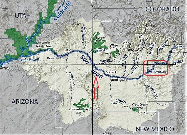
A tributary to the Colorado River. As it flows through New Mexico the plateau landscape has an arid climate, with approximately 160 days of yearly seasonal farming capability. Therefore the river provides an irrigation source.
In 1956 the U.S. Bureau of Reclamation planned reservoirs as water storage support for the Colorado River. One of the San Juan River lakes in New Mexico was created for this: Navajo Reservoir.16
Along its winding course through New Mexico, you'd discover adjacent fluvial lakes. These are oxbow lakes and lateral lakes. Most of these are unnamed.
But Navajo Lake is the largest we'll find in its direct route, and the 2nd largest lake in New Mexico. You'll note at its outflow, downstream, it delivers waters into Lake Powell.
NAVAJO LAKE - With lake-acres totaling to 14,500, it has so much to offer.
Like camping, swimming, & scuba-diving, fishing, boating, water-skiing, birding, night-sky watching, & hiking.
Marina rentals, or bring your own watercraft. All varieties of camping, including cabins & pre-arranged reservations. Fabulous fishing here, including an autumn into winter Kokanee salmon run.17
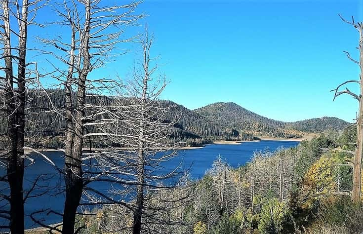 Gorgeous Navajo Lake
Navajo Lake State Park - The best way to access this park, all-around is via the state park. Two of their marinas on either side of the lake offer watercraft rentals.
WiFi is available at the park. Plenty of camping, with all kinds of options. Elec/water sites, or primitive, lake-side, boat-in, dump-station, reservations, & restrooms with showers.18
- East of Farmington, take US-64E to Blanco, turning North on Hwy.511 to the lake.
- For noncampers, the closest area is a very nice riverside Blanco Stay - not far down the road. Other wise it's Bloomfield or Farmington.
Even More Lakes in New Mexico
Is that the total of lakes in New Mexico? These lakes along New Mexico's major rivers? Not at all!
There are plenty more lakes in New Mexico, scattered throughout this diverse state. There are actually more than 1200 New Mexico lakes!19
Maybe we'll eventually get to them all. We can surely hope so!! What are some others that we might think of?
- There are lakes near the Gallup New Mexico area.
- Some gorgeous lakes are around exquisite Taos NM.
- What about Santa Fe NM, there are lakes to experience around there.
- How about all New Mexico lakes where there are cabin rentals.
- We're working on showing you a map that has many of the lakes in New Mexico.
- Have you heard of New Mexico's Twin Lakes, or Latir Lakes, or Canjilon Lakes? We have!
We're working on getting to all of the above, and more. So keep us in mind, and come on back to see the latest.
See References For Lakes in New Mexico>
Some Directional Information on This Page May be sourced from Map data ©Google


