Drought in Western USA
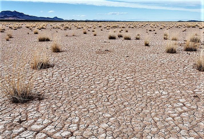
Drought in Western USA is a consistent fact in more recent years. Some areas face heavier problems compared to others. Some states have more drastically urgent concerns than others. But all of us are in this together, really. As it all has to do with water. A necessity of life. Along with the air, it's really the basis for life on earth.
Think of ground-water, supplying the water table, contributing to plant growth, & more. That in turn makes possible other life. Everything is interdependent. That's ecology for you!
Here we're especially concerned with drought's effects on the waterways of the West. They're vital to so much in the environment. We always look at how drought affects some states in the Western USA.
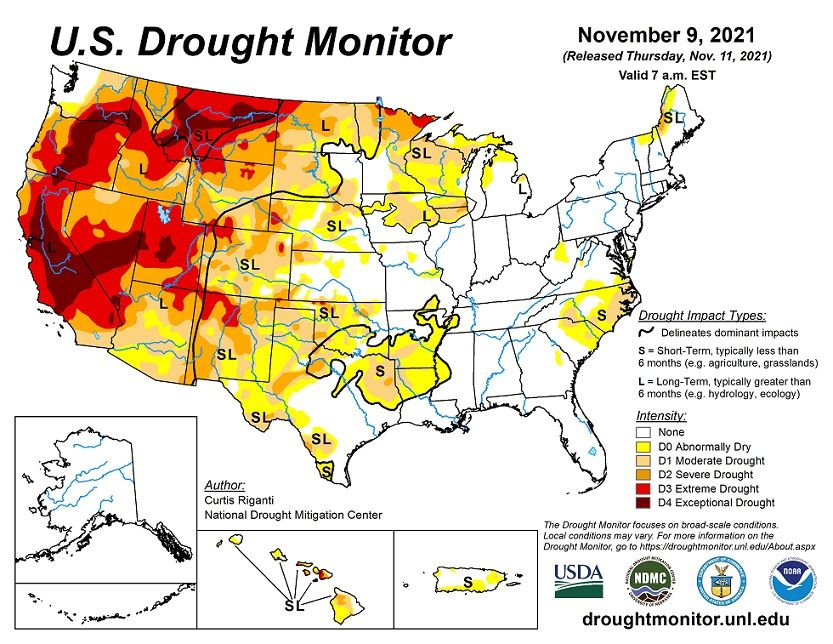 Late 2021 Map Demonstrating the Drought in the U.S.A.
Drought Meaning
Before looking into each of the eight Western U.S. states we're mainly concerned with, we want to be sure of the meaning or definition of drought. For that we consider several aspects:1
- Lengthy time-frame, with less than normal average amount of precipitation from the atmosphere
- Inadequate/not enough of whatever form is bringing moisture to the earth: rain of any description, snow/sleet/ice, heavy fog, condensation forming dew
Drought Monitoring Evaluations
Evaluated Multiple Ways
- Palmer Indices:
- Palmer Z Index - Checks moisture output within a month, ranking short-term drought vs. precipitation
- Palmer Drought Severity Index - Rates 12-month precipitation, considering weather patterns, compared to norms
- Palmer Hydrological Drought Index - Assesses year's moisture by checking reservoirs & water tables
- Palmer indices are easily computed. They figure out water balance by incorporating temperature, precipitation, run-off & evaporation. The drawbacks: timing isn't uniform, drought warnings lag, poor accuracy in mountainous/extreme climates, drought categories arbitrarily set.
- Standard Precipitation Index
- Looks at specific time-frame to analyze likelihood of precipitation events
- Standard Precipitation Index can look at specific short or long-term drought analysis, using long-term precipitation data. It gives the diversion from the average (+/-). Detects drought possibilities early. Drawback: No consideration for evaporation or seasonal differences.
- Watershed Methods2
- Use of water gauges for evaluating streamflow within watersheds over two to four years, compared with long-term data.
 Normal Water Cycle - Interrupt It In Some Way & Drought Can Occur!
Drought in Western USA State of Arizona
Water via precipitation is normally infrequent in this State of Deserts and "Sky Island" mountains. This situation makes Arizona easily susceptible to drought conditions.
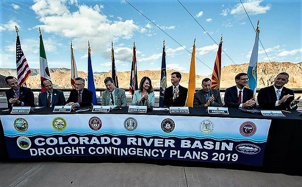
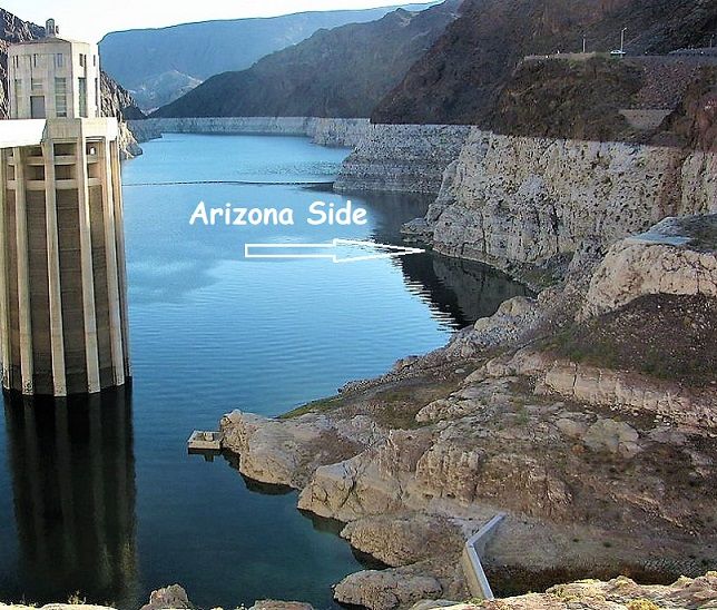
Arizona depends on a supply of water from the Colorado River. It must manage that river resource very carefully.
The Colorado River Compact made an agreement to allocate the river's waters between river basin states. Additionally, Native American rights to the river's water was insured with a 1963 Supreme Court ruling.
Many new residents have moved to Arizona, increasing pressures on water supplies. When drought is at hand it affects citizens in ways they may not always notice. Others definitely notice! Ranchers & farmers, plants of the forest & fields, & animal life.3
Some Arizona drought details:3
- Though not as dramatic as sudden catastrophes, drought is a destructive natural disaster, often arising slowly, but with large financial impact
- Arizona's drought began about 1994.
Arizona's mountains get winter snowfall, the largest prevention for drought.
Snowmelt runoff happens slowly in cooler weather when water demands are less. Creating natural water storage. As weather warms up melting increases. Groundwater & reservoirs are better replenished, rather than with quick intermittent rainstorms.
Arizona hasn't received adequate snowfall to ward off drought since 2000.
To overcome drought in this Western USA state, above average precipitation is consistently needed over time. Particularly mountain snow.
To help, regulations on water usage have been placed. With some areas having restrictions on groundwater usage. Unfortunately there aren't statewide water rules.
Drought in Western USA State of California
At the beginning of 2014, Governor Brown declared a California drought emergency. The drought actually began two years prior, but reached emergency status that year. By 2016, with water conservation efforts & actions, the emergency status was relieved. The statewide drought lasted five years.4
But California is still challenged today with drought conditions. A Water Bank was implemented. Plus other management planning:
Drought in the Western State of Colorado
Colorado is using a Drought Monitor for evaluation of drought levels. Another evaluation method, using a kind-of likert scale, or a leveled rubric.
It evaluates consequences in the state because of drought. It also considers the severity of particular repercussions in an area.
Deciding which ramifications to consider was based on problems seen during historical droughts.
For instance:
- Is irrigation beginning earlier?
- Are rangeland plants stunted?
- Are wildfires increasing?
- Is snowpack low?
- Are lake/river water temperatures rising?... And/or
- Are dust storms increasing?
- Plus numerous other factors.
Drought in Western State of New Mexico
The drought in New Mexico, in the Western USA is monitored in a similar method to Colorado. But the appearance looks a little different.
They use five different Levels of Drought, from Abnormally Dry to Exceptional Drought.
Drought in Western USA State of Nevada
Nevada water usage by residents is concentrated in a few areas, such as the greater Las Vegas area, and Reno.
Nevada cautions its citizens that water used outside in many instances evaporates in this dry desert climate, and thus cannot be recycled for reuse. So especially in Southern Nevada, which has the largest concentration of people, many water usage plans are in place to help with drought mitigation.
Drought in West: USA State of Oklahoma
Oklahoma provides several resources for checking on drought conditions in their state, as well as the Western USA.
- They provide a map of groundwater levels, which has environmentally important relationship with drought conditions.
- For checking the status of Rivers and Lakes, a map shows you the condition of Oklahoma stream flow.
- Another map monitors areas of the state which have high levels of fire danger, related to Western drought conditions.
- A country-wide map shows the outlook for drought in the Western USA.
- Try some water conservation tips they have listed for you.
All in all lots of Helpful Information on Oklahoma drought circumstances.
Drought in Western State of Texas
The current drought in Texas began in 2010.
Higher summertime temperatures of recent years are causing excessive evaporation of water resources from reservoirs. Since 2010 the average temperature is 2oF higher.5
Ground areas dry out from this heat also, affecting rivers, which then affect connecting lakes.
In intermittent years rains from hurricanes and other substantial storms alleviate drought for a time, but the effect is temporary.5
Thus drought in the Western USA state of Texas is something to regularly contend with. Serious, because of the many widespread detrimental effects.
There have been wildfires, city water failures, water restriction/cut-off for farming, increased dust storms, roadway & tree damage, crop & beef price upward swings, & endangerment to power plants.5 There is no upside.
Texas approved a State Water Plan, with included measures to encourage water conservation.5 The Most Severe drought areas are in West Texas & in the Pan Handle.
Drought in Western USA: State of Utah
Water supplies for Utah's citizens arrives via their mountains' snowpack. As much as 95% of it!6
The state of Utah, throughout 2021, has been in a drought. Most areas in the extreme range, some parts in the severe range. A very small portion of Utah suffering from moderate drought.6
The state's Division of Natural Resources, Division of Water Resources, congratulated residents on their water conservation over the year of 2021: "Billions of gallons saved!"6
To help educate the public, Utah sponsors Drought Webinars. Plus lots more great information to help work against a drought.
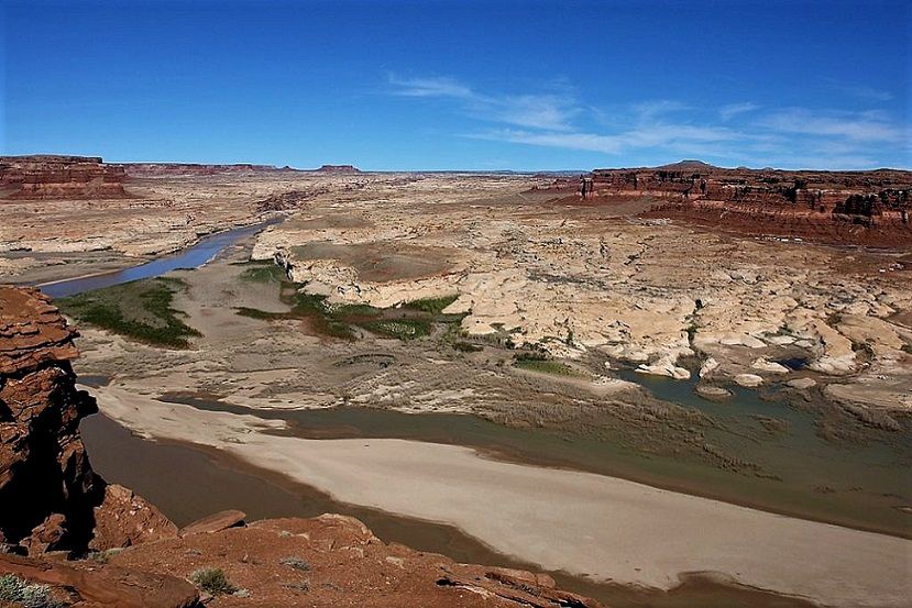
In Canyonlands National Park in Utah, the Green River merges with the Colorado River. Shortly, if rafting downstream, you'd enter Cataract Canyon. Known for Class III, IV & V rapids.
Lately the Green River hasn't helped much with the resulting effects of the drought in Western USA. It's been complicated, for take-out spots at Lake Powell & related areas. Plus impacting rapids.7,8
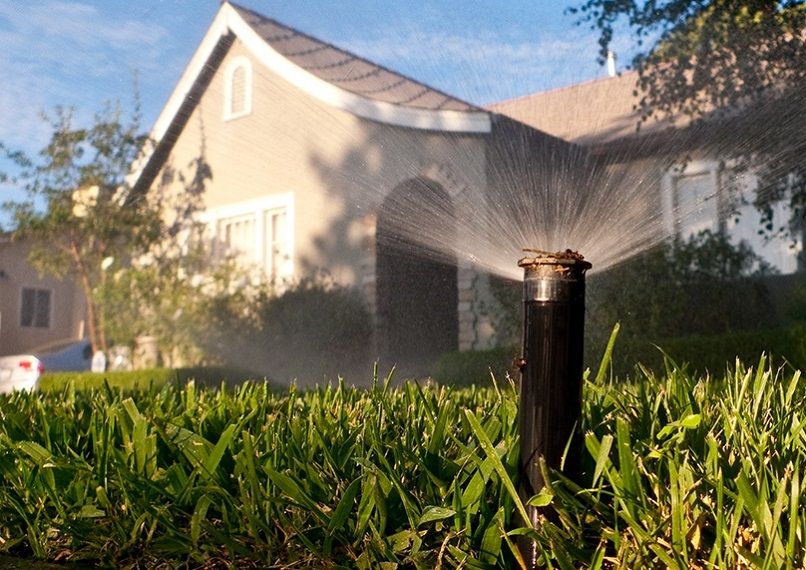
Drought in Western USA states, in fact wherever in the world it's occurring, is a serious event. We can all do our part for water conservation, and preservation of our natural resources.
Our lakes and rivers depend on your assistance.
See References For Drought in Western USA>
Some Directional Information on This Page May be sourced from Map data ©Google

