Red River in Texas
The stuff of movies & songs. The Red River in Texas has much history and legends attached to its name.
Generally forming the Texas/Oklahoma border for much of its length. Plus some of southwestern Arkansas. The total length of it altogether is 1,290 miles. But in Texas it flows for 695 miles.1 That's a bit more than half its course!
With purchases made via links on our site, we may earn a small commission at no extra cost to you. Details at our Advertising Policy.
Lots of oxbow lakes along its course. Most unnamed & small. But a few larger & named.
Its Texas headwaters surround Canyon TX. Together we'll ride and flow along. Discovering all there is to see as we go!
How the Red River in Texas
Gets a Sputtering Start!

With desert springs popping up & groundwater sources, the Red River in Texas source is westward just over the the New Mexico border.1 The headwaters begin with two creeks in the Texas Panhandle.
One is Palo Duro Creek a little northwest U.S. Hwy.60/87 junction.
The other arises from Hackberry Creek, flowing into McSpadden Lake. Adjacent to the lake (likely private access) is Southeast Canyon Park in Canyon TX for public access.
- This Local Park usually has waters for some good fishing!
From the lake's dam is Tierra Blanca Creek. Its confluence with Palo Duro Creek is just west of I-27 exit 108. Together they meander & soon widen into a lake...
Palo Duro Club Lake - At 56 surface acres, it provides access for residents, guests & club members. The containment lets out into a stream, often locally named & intermittently dry. Widening out soon to form...
- Lake Tanglewood - Many lakeshore homes here surrounded by rural area, on a Private Lake. Dammed at the south end. Outlets where Cedar Way Draw curves up into more lake waters...
Currie Lake - Eastern side's roadway has lake views, no homes here upon this writing.
- The area of Tanglewood & Currie have long family-related History. The small dam at the eastern corner lets out excess flow. Now becoming locally named draws.
All along its upper reaches, barring its main source creeks, there aren't any real tributaries. Some scattered arroyos connect, bringing valuable rainfall water at times. As it trickles along, it now approaches an amazing place...
Palo Duro Canyon State Park in Texas
Palo Duro Canyon State Park - Excellent spot. As you begin to advance toward the park area, you'll be driving on Texas caprock & loamy type geography of the high plains.11 Then suddenly, very dramatically, you see a large hole in the ground! Out of nowhere it's this wondrous canyon. You'll take an elevation dip into it to go into the park.
- Driving into & through the park, you can view the upper expanse of the Red River in Texas flow along here. With rain it can even become a rushing torrent!
- We camped here once when our kids were young. Highly recommend it. If you'd like to grab a campsite, they recommend Reserving Your Site. They book up fast, even for Day Use. Especially in the summer.
- One Reason: Summer offers The Texas Outdoor Musical. Entertaining family show staged Tues-Sun. Themed around the life of early Texas settlers. They even have fireworks!

Prairie Dog Town Fork Red River
Exiting the park, it resumes trickling twists & turns through desert. The banks widen & it's called Prairie Dog Town Fork Red River.
In the midst of this section, the first significant (although really not very significant - it's all relative in the Panhandle!) tributary cuts in from the north.
It's called Campbell Creek, in Randall County. Just before approaching Goodnight Canyon.
Soon a small dry wash called Tule Creek converges from the southwest. During rains it will certainly collect rainwater, adding to the Red River in Texas's flow.
Crossing the southeast part of the panhandle, it runs under the State Hwy. 70/256 bridge. As you can see, it kinda "dribbles" along!

Red River in Texas Tributaries Begin
As you're nearing the eastern border of the Texas Panhandle, the first real Texas Red River tributary enters from the north.
Named Salt Creek, it normally trickles along. With headwaters in an area of the plains with shrubs, trees & grassland. A bit northeast of Estelline.
The Texas's Red River ends at OK's border, just northeast of Childress TX. At the most southeasterly point of the Texas panhandle.
Red River Bordering Texas & Oklahoma
Now the Red River shares a meandering west-to-east border with Oklahoma.
- Sometimes on the OK side, sometimes on the TX side.
- Sometimes sharing both borders.
- But much of the time the Red River on the Texas side switches, and goes over into Oklahoma lands.
- And then it can change again!
Groesbeck Creek is a major tributary for the Red River in Texas. Its confluence is Northeast of Quanah TX.

Many More Red River Tributaries
Oklahoma Red River Tributaries - Coming next...
- Gypsum Creek merges just over Texas's state line, north of Odell.
- Salt Fork Red River is the significant tributary with a confluence wholly within Oklahoma.
- Winding away it goes, crossing borders, north & south, then sharing again.
- About 10 miles north of Vernon TX, the river allowed a ford called Doan's Crossing.
- Vital in the 1800's cattle drives. Today, it's an Oklahoma Historic Site.
- Not far southeast was Doan's Store. J. Doan opened the operation in April 1878. Supplying cattlemen with ammo & basic foodstuffs. Before they forded the Red River in Texas.2
Pease River in Texas
Approximately another 10 or 12 miles downriver, another lengthy tributary merges from the southwest.
The Pease River, it often seems more stream-like. If even that! But it usually manages to flow along.
Finally merging with the Red River in Texas, about 8 miles north of Oklaunion TX.

About 20 miles downriver, a feeder creek comes in.
Adams Creek has an odd confluence with the Red River in Texas. It flows in & then flows out!
 Adams Creek - It Flows In! It Flows Out!
Texas & Oklahoma Red River Creeks & Rivers
Wildhorse Creek is the next notable confluent.
- Entering the Red River, just barely outside Texas, into Oklahoma.
- And east of I-44 exit 14 in Texas. Which enters Burkburnett TX.
About 25 miles further on is an important inflow.
- Cache Creek enters just north of the shared border of TX/OK.
- Connecting on the north side, from Oklahoma.
Wichita River is next. Converging with the Red River in Texas.
- Just barely! Before the border goes Oklahoma way.
- A huge oxbow lake is adjacent, southwest of the confluence.

14 or 15 miles downriver, you can get across from Texas into Oklahoma. Take State Hwy. 79 out of Byers TX. Head north for about 10 miles to cross over here...

Beaver Creek is an important Oklahoma tributary. Flowing in on the OK side, northeast of Stanfield Texas.
The Little Wichita River confluence with the Red River in Texas soon approaches from the west. About 10-12 miles northwest of Ringgold TX.
The Red continues flowing until bubbling under U.S. Hwy.81.
The Old Chisolm Trail Texas Crossing
Rolling through a large curve up to Red River Station. The basic starter & main crossing for the Old Chisholm Trail.
- The river bend slowed the Red River's flow. For easier cattle crossing at this point. A town arose serving cattlemen. Now it's a "ghost town" with a marker.3
Still winding & flowing through lots of farming area. The Red River in Texas's bottomlands make for rich agricultural soils.
After a huge twisty bend, there's a major confluence from the west...
Fish Creek - Up-creek from its Red River in Texas merge, its waters come from Hubert M. Moss Lake.
- That lake's waters are sourced from South Fish Creek & North Fish Creek.
About 4 or 5 miles downriver, an unnamed creek enters the Red River in Texas. The Red shortly passes under I-35.
The river then swings northward before curving east again to meet up with a southside confluence.
Hickory Creek just over the OK line. But flowing in from Texas.
 Hickory Creek With Good Flowing Waters!
The Red River in Texas takes an unmistakable horse-show bend when next approaching another confluence from the south.
Rock Creek combines with the Red.
Soon Sycamore Creek, somewhat an ephemeral stream comes along, that also connects to an oxbow lake.
Before you know it the flow abuts what seems to be a large lake! Yes it is...
Lake Texoma
 Lake Texoma Awaits You!
Reasonably named! After all the shores are shared between Texas & Oklahoma.
- Lots of Texas-side Recreation: Eisenhower State Park, Island View Park, Highport Marina, Mill Creek, Texoma Harbor Village area, Walnut Creek, Cedar Mills & Juniper Point Public Use area.
- You'd have plenty of private choices of places to stay, along with cabins or campsites.
- Several streams join the lake from the south & east in Texas
- Deaver Creek into Big Mineral Creek
- Myer Branch flowing into Harris Creek to Lake Texoma
- There's another inflowing creek near the parking area to the Photo Blind at Hagerman National Wildlife Refuge
- Denison Dam outlets water into Shawnee River & back to the Red River along the OK border.
Many Creeks Ahead for the Red River
Shortly after flowing out of the dam, the Red River in Texas takes in more waters.
- Shawnee Creek confluence on the south.
- Which created Randell Lake along its flow to the Red.
North of Denison, it now flows under State Hwy. 75/69.
Duck Creek soon merges from the west, after the Red bent southward.
Pawpaw Creek then comes in from the south.
Choctaw Creek ahead, merging from the west after a few winding flows.
Brushy Creek adds to the flow before twisting back up.
Canney Creek is an eastward confluence after the Red takes a northward twist.
- A look at this area, with the flowing Red River in Texas, north of Bonham Texas.

Sandy Creek & then Cottonwood Creek flow in after the Red River in Texas bends eastward again. That's just before reaching State Hwy.78.
The highway crosses the river, going from Texas into Oklahoma via this bridge...

Major Red River Confluences to Go
Sycamore Creek comes from the south, after the Red just flows out from the bridge.
The Red River in Texas continues meandering along, jumping the TX/OK borders again & again. Through rural farm areas.
When a major northern confluence enters:
Oklahoma's Blue River. Next is...
Texas's Bois D'Arc Creek merge from the south.
Slough Creek, a lesser southern inflow.
A few more curves & a few more unnamed creeks flow in.
- North of Razor a stream merges...
- Dead Man Branch - Creek with two upstream branches. One includes a nice oxbow called Palmer Lake.
- Muddy Boggy Creek - Primary northern confluence from OK enters next.
- Sanders Creek soon merges from the southeast. Also serving as the water source for Pat Mayse Lake.
Oxbow Lakes Aside the Red River in Texas
Just north of Arthur City, the Red River passes under State Hwy.271. Winding a bit further east an substantial oxbow adjacent.
- Called Womack Lake.
Pine Creek is the next confluence from the south.
Oklahoma's Kiamichi River then adds Red River flows from the north.
Two creeks merge in on opposite border sides:
- Ford Creek from Texas
- Doaksville Creek from Oklahoma
Cedar Creek, then Clear Creek - two confluences coming down from Oklahoma.
Newer Texas Oxbow Lake
A newer oxbow lake has formed between TX/OK borders aside the Red River.
Accessed from Red River County, TX.
You can see it's aside County Rd.2381 or Farm-to-Market Rd.410. That's northwest of Albion TX.
 Mapping a Relatively Newly Formed Oxbow Lake
Shared by Texas & Oklahoma
Because of the ambling methods for the Red River, not surprising that 2 more named oxbow lakes (among so many more unnamed) are adjacent to the river flow.
New Lake - Typical horseshoe formation.
Brushy Lake - The smaller, thinner size.
 Two Red River Oxbow Lakes
At Texas Hwy.8, near Woodstock TX, north of New Boston, the Red begins its Texas/Arkansas border.
Whaley Lake comes along soon. A prime Texas oxbow lake example, adjacent to the Red river.
The Red River ends flowing through Texas at State Hwy.71 in Northern Texarkana TX. Right at the Arkansas border.
How About Some More Red River in Texas?
More Pages You May Like:
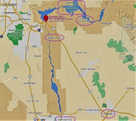
Lake Mead Arizona - We Get You There!
Lake Mead National Recreation Area on the Arizona side of the lake has some water areas left. Boat rentals, fishing, best camping spots + see Hoover Dam
Things to Do at Lakes - Top Ideas, Tips & Info
Covering things to do at lakes: lots of the ways you can have fun - with the family, on dates, getting exercise, where to go, can you imagine more? We can!
Utah State Parks With Cabins - Find Your Stay
Utah State Parks with cabins are in all areas of the state. Stay in any of them, or one of the unique alternates. Have fun while seeing these wonderful places.


See References For Red River in Texas>
Some Directional Information on This Page May be sourced from Map data ©Google
If You're Enjoying This - Please Pay it Forward
Send It/Share It

We're From Arizona & We Know Our Southwestern Home
We Love Helping Others Appreciate It Too!
Supporting Local Businesses Throughout the Southwestern USA
Privacy Policy | Terms/Conditions/CC Licenses | Advertising Disclosure | Contact Us
© SWlakesUSA.com: 2021-2022 - A Production of Picture Rocks Networking LLC | All Rights Reserved
As an Amazon Affiliate we earn from qualifying purchases.
WE DO NOT SELL ANY PERSONAL INFORMATION FROM THIS WEBSITE
This site is protected under U.S. and International copyright laws. Do Not Copy - No use is permitted without permission.

