Lakes In Nevada
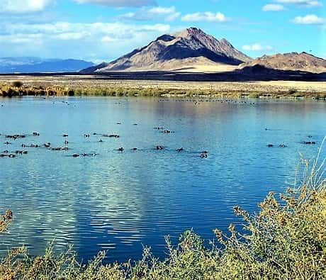
Lakes in Nevada are a delight when traveling through this Mojave Desert state! We've traveled through Nevada quite a few times, from North to South, East to West.
We haven't covered all its territory yet, but maybe it's our goal!?
We live somewhat close, in Arizona. So we're a hop, skip and a jump away from visits to those lakes in Nevada. What have we discovered there?
Read on to find the Nevada's lakes' circumstances. OR Choose Your Preference:
Can We Find Lakes in Nevada?
Nevada is mostly desert, the Mojave, and the Great Basin.
- The Great Basin means it's a kind-of bowl shaped area, with water sources, such as rivers/streams, draining within.4
- Without flow to great gulfs or oceans, this creates more possibilities for salt lakes. Natural salty sands leach into watery basins where lakes formed.
The Mojave Desert in Nevada is temperate in nature. Meaning that winter precipitation is often snow, and summers are hot, mostly dry. However, sky islands have elevation changes with entirely different floral/faunal environments.4
Because of all this, total numbers of lakes in Nevada are fewer than visitors may first hope or imagine. But we're here to get to the watery lakes in Nevada, because they can be found!
What Causes Dry Lakes?
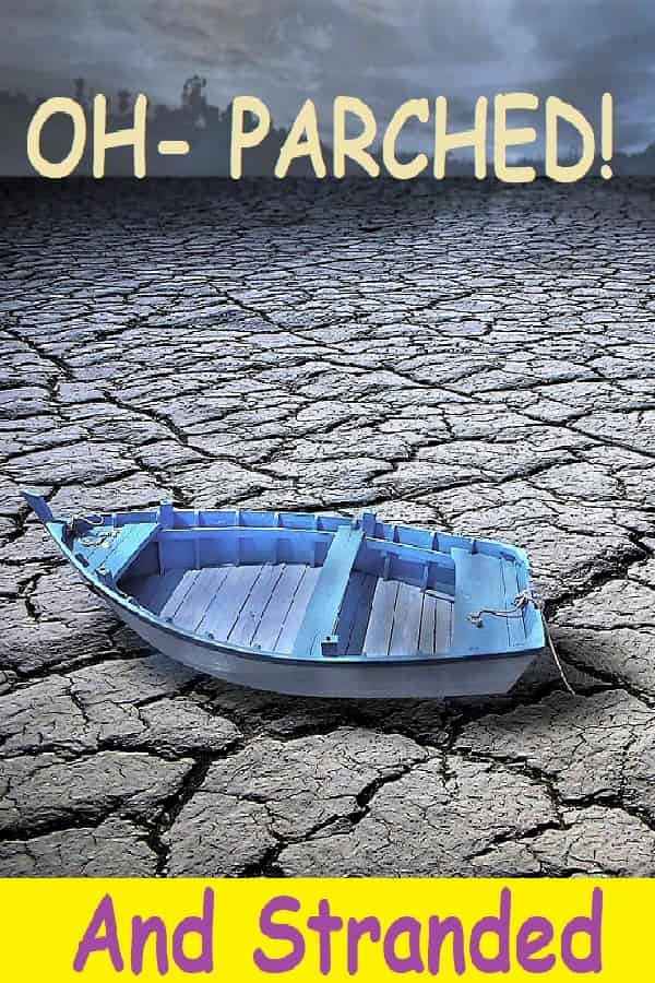
Many "dry lakes" are scattered throughout the Southwest, including Nevada. Also called playas. Sometimes because of the minerals left after they dry out, they're called salt flats or alkali flats.
Dry lakes form when water first flows, gathering into recessed land. But there's little to no outflow.
Then with excessive evaporation, the water dries up. That's when it becomes a dry lake.
At times, lots of rainfall refills the lake, but it can dry up again. Dry lakes are most common in arid regions.5
4 Major Lakes in Nevada
Let's start with considering some Major Lakes in Nevada you should know about.
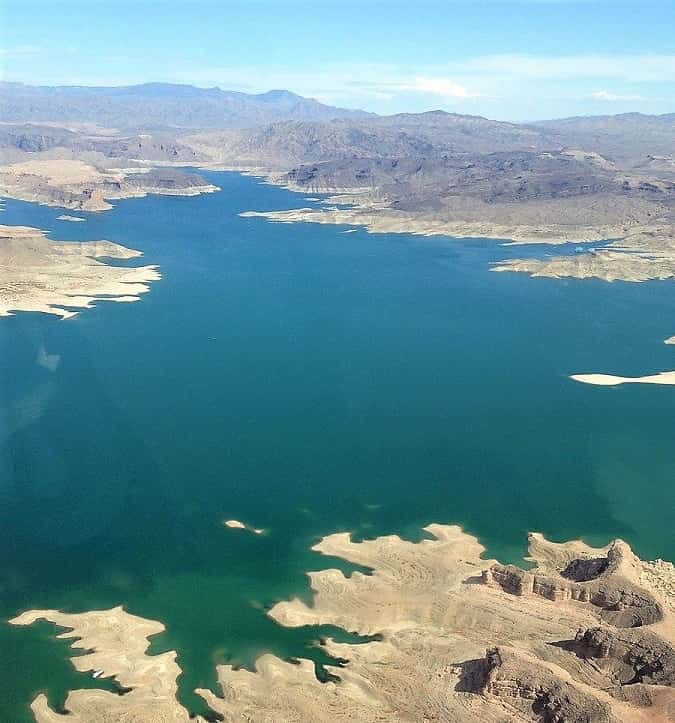
LAKE MEAD - From damming the waters of the Colorado River, this lake is shared along borders With Arizona. Quite popular, as it's been among the largest for the state and near the biggest population centers of Las Vegas & Henderson.
All activities can be had there, including swimming, boating (really - all sorts of water sports), shoreside camping, & fishing.
Lake Mead is near Southern tip of the state, where the border takes a little swivel.

- Nevada's largest. Sadly in recent years it's been struggling with lowering water levels because of Western Drought conditions. The Colorado shares river resources among the states through which it flows, a cooperative effort. Drought brings less flow (among other problems), thus the lake's share of water diminishes.
- Hoover Dam is a stunning, impressive construct.
- Visiting the entire area, and choosing different things to do can definitely occupy a week's vacation time!
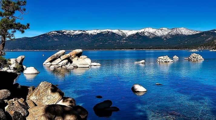
LAKE TAHOE - Now from from the SE border of Nevada, look upward to the NW border with California.
You'll find this gorgeous lake amidst Ponderosa & Lodgepole pines, alders & cedars. At 6,225' elevation it's the deepest lake in the Southwestern states. One reason the water's so clear!
Although the area experiences four seasons, it gets many sunny days typical of the Southwest. About 100 days of the year bring in precipitation.1
Although most of its shores are in California, the Nevada side has some wonderful areas to visit. Nearby cities to plan your surrounding trip are Reno & Carson City.
For instance, Sand Harbor State Park, with its highly rated beach is very popular in the summer.
Drive 2 more miles south into the National Forest to find Chimney Beach.
- Named for an old chimney on the shore. No facilities, so pack in/pack it out.
- Small parking area to small beach. Must hike a trail to it, but worth it!
Nevada Beach is southernmost of the lake in the state, & probably the best. Think our favorite!
- Large sandy beach. You can swim & Camp Here (no utilities). Day use also.
PYRAMID LAKE - Huge, dazzling natural lake, remnant of an even larger ancient one, but now about 125,000 surface acres.
On Paiute tribal lands, located about 35 miles northeast of Reno. When there, you must ensure to abide by tribal regulations. For instance, boating, swimming, fishing, camping, etc. need Tribal Permits.
- Unique fishing opportunity for Lahontan Cutthroat Trout & Cui-ui fish.
- Don't miss the Paiute Tribal Visitor Center & Museum to learn about the lake's history & the importance to their people.
- Very scenic area, with distinct natural rock structures.
- However, note that Specific Areas are closed to the public: Needles & Marble Bluff areas, Beehives, Pyramid/Stone Mother & Anaho Island, etc.
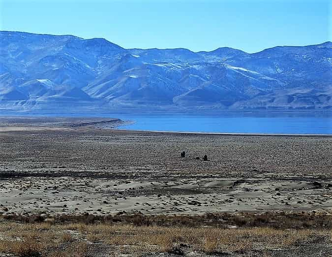
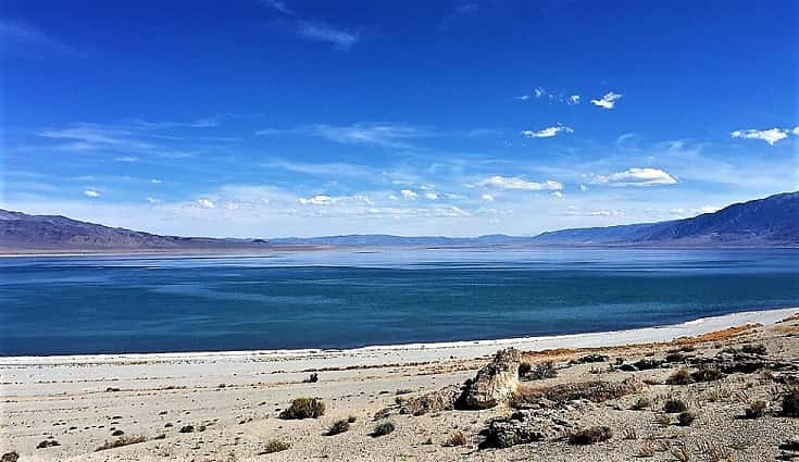
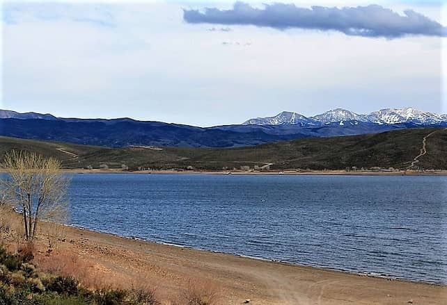
WALKER LAKE - Another natural and significant lake, remnant from the Pleistocene era. Adjacent to Highway 95 in the Western mid-state area.
Recreation had centered around it at the BLM Recreation Area and Walker Lake State Park.
Recently, with agriculture needs & drought evaporation, this is one of several lakes in Nevada with severely Decreased Water levels.
As a salt lake, the salinity has become more concentrated, leading to detrimental effects, such as fish-kills.
Traditionally fed by the Walker River, with headwaters in the Sierra Nevada. Now virtually no water left by the time it reaches the lake.
This podcast tells its story:2
Swimming Lakes in Nevada
LAKE MOHAVE - Sharing this lake With Arizona, Nevada has its Western shore.
Created from Davis Dam, north of Laughlin, containing waters of the Colorado River. Remember, there are no lifeguards at any beaches, swimming at your own risk.
- The most comfortable area is Cottonwood Cove, with its sandy beach. Nearby amenities at the marina. There are picnic tables & loaner life vests. It's a swimming only beach, so NO watercraft allowed.
Directions From Searchlight NV: Go east 14 miles on Cottonwood Cove Road.
LAKE MEAD SWIMMING BEACHES - Many good places to swim on such a large lake!
But remember, no lifeguards. Deaths have occurred because of careless actions. Always supervise children.3 If you have a boat, swimming is always possible from there!
West End of Mead: Several off of Lakeshore Rd., enter via Boulder City Entrance Station. No overnight camping at any. None have picnic tables, all are fairly rocky so have Beach Shoes.
- Watercraft & Pets Allowed: Canoe-Kayak Beach/PWC Beach
- Life Jacket Loan-Outs: Boulder Beach/Special Events Beach/Canoe-Kayak Beach
- No Pets: Boulder Beach
North Shore of Mead: A few locations, some remote, suitable for swimming. May require a stay, check locally.
- Government Wash Campground - RVs & tenters boondock area. Free after Rec Entry. Sandy lakeshore. Turn off Hwy.167/Northshore Rd. onto Government Wash Rd.
- Boxcar Cove - Turn off Hwy.167/Northshore Rd. onto Boxcar Cove Rd. Dirt road to the lake. Nice sandy shore, used to allow camping - seems no more. But day use OK.
- Callville Bay Campground - Nice NPS campground, 1st come-1st serve. From their marina, they even have Houseboat Rentals. Plus several full hook-up sites. For inquiries: 702-565-8958
- Echo Bay - Try multiple campgrounds in this area, depending how you're preferring your stay for swimming. Lower is NPS. Another, RV Village has full hook-ups. Turn off Hwy.167/Northshore Rd. onto Echo Bay Rd.
TOPAZ LAKE - Haven't gotten here yet, as far as we can tell, swimming allowed.
Water skiing & jet-skis all around. Topaz Lake Park, has reservable Campsites.
Looks pretty nice & it's on our list. Shares California border. South of Gardnerville, turn left from Hwy.395 onto Topaz Park Rd.
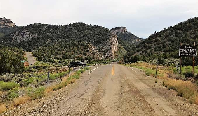
CAVE LAKE - 32 surface acres have year-round opportunities. Waters enter from Cave Creek & Steptoe Creek.
Swimming is allowed in the State Park. Day use, as well as campgrounds. SE end of the lake has picnicking, with float-tube launching. Other sandy beach areas along East side of the lake.
Recently the Cave Creek Dam, which created the lake, was found to have dangerous issues. And is having repairs made. Until then, no-one is allowed in/on the lake. For updates send email: clsp@parks.nv.gov
But the park is still open. From Ely, 50E, left at Hwy.486 to park.
Are There Lakes in Reno Nevada?
Visiting the Reno area? You might be looking for lots more ways to spend time than just the slots!? What's curious is Reno's historic name was Lake's Crossing. Not from a lake, but named after the toll-bridge owner, for crossing the Truckee River!6
How about nearby Reno lakes in Nevada? Yes, there are ones we think you'd enjoy.
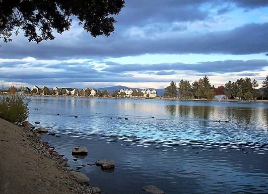
Virginia Lake - The city's Lake Park at 1980 Lakeside Dr. provides access.
- Amenities include walking path, picnicking/grills + tables, benches, playground, exercise court & dog-park.
Sparks Marina Park Lake - City sponsored. 77 surface-acres near downtown.
- Walking paths, swimming beaches, picnicking, playgrounds, dog-park, fishing & more! 300 Howard Dr. 775-691-9130.
Manzanita Lake - On the campus of the University of Nevada Reno.
Alexander Lake - This is somewhat of a mystery. Prior jurisdiction of the county, annexed by the city, they stated there's no master plan for it.7
- At one time there was water, but on Google Earth, it now looks dry.
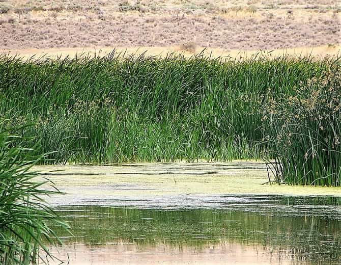
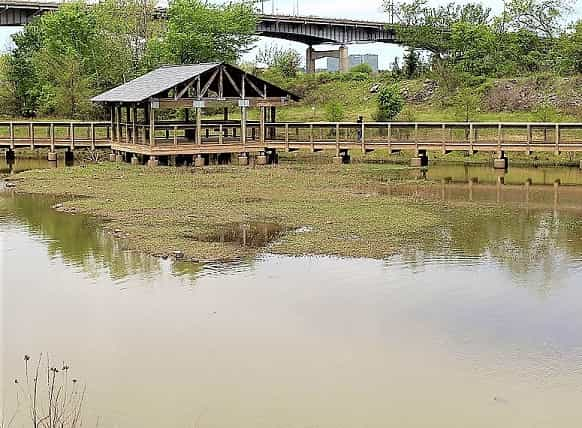
Swan Lake - Essentially a playa, with about 50 permanent wetland acres that rise to 1,000 acres in optimal precipitation years.
Most area is public via BLM, County & State National Guard. But some private holdings. There are interpretive boardwalk/trails with kiosks & educational boards.
- Take 395N out of Reno, Exit 74, Hwy.164N/Lemmon Dr. Left on Military Rd., right on Lear Blvd.
Private Lakes - Value for ground water recharge, watershed preservation & development buffer areas. But No Public Access:
- Lake Stanley - Owned by gated community adjacent to a golf course.
- Silver Lake - Owned by several private landowners.
Reno City Plan - For Reno's Lakes in Nevada, as well as its rivers, greenways and riparian areas, Reno has a Master Plan. It are aims to connect privately held lakes with pathways that have public access. Plus much more for public improvement.8
Unique Reno "Lake"
How about a local crazy kind of lake in Nevada, one that really shows kids a fun day! With a Lazy River, the Bahama Mama, attached??!
Best Las Vegas Lakes in a Dry Desert
If ever there was a desert area, without much to say for lakes in Nevada, it's the Las Vegas area. However, we've located a few, for serious lake searchers!
Railroad Lake - In Henderson, surrounded by Cornerstone Park. Open 6am-midnight, this city park has grassy areas, picnicking, walking trails, exercise course & much more. Pretty popular, as the only city park with a lake!
- At 1600 Wigwam Parkway.
Aerial Tour of Railroad Park
Clark County Wetlands Park - Funded in 1991, it's become a fantastic place for outdoor activity & gaining valuable nature information. No off-roading, fishing, swimming, boating, hunting, camping, drones, etc.
Open from dawn to dusk, it's a preserve-like wetland situated along the major Las Vegas Wash, where that aura is maintained.
TO DO:
- Take a Guided Tour
- See the Nature Center
- Absolutely take the trails through the Nature Preserve - winding through 210 acres, over three miles, viewing the weir manipulating recycled city water. Which creates the Boardwalk Pond, North Pond & Vern's Pond (with an island bench).
Henderson Bird Viewing Preserve - This site on the eastern part of the Pacific Coast Flyway attracts lots of birds venturing across desert areas. There are birds for every season. 3/4 mile paved walkway, plus dirt trails amidst 9 ponds.
- Closing hours vary, but count on open times from 6-7am. 702-267-4180
- Find Them: via 350 E. Galleria Dr. at Moser Drive.
Lake Las Vegas - This private lake allows public entry via the Marina. With 320 surface acres, you can rent electric, paddle or foot-powered boats, plus other items.
Even charter a yacht for your own special party or event!
- Get There: From the junctions of Interstates 515/215/11, take Hwy.564/E.Lake Mead Parkway. Turn left (East) at Lake Las Vegas Parkway.
See References For Lakes in Nevada>
Some Directional Information on This Page May be sourced from Map data ©Google
