Arizona Rivers and Lakes
Arizona rivers and lakes are related to each other. Without one, we'd struggle to have the other! Our water resources in Arizona our precious. We do all we can to use them wisely, and encourage others to do the same.
We'd like to introduce you to some of our beloved Arizona rivers, and the lakes they've created. Which we ourselves like to visit often!
With purchases made via links on our site, we may earn a small commission at no extra cost to you. Details at our Advertising Policy.
Big & Small Arizona Rivers and Lakes
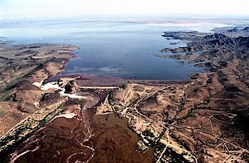
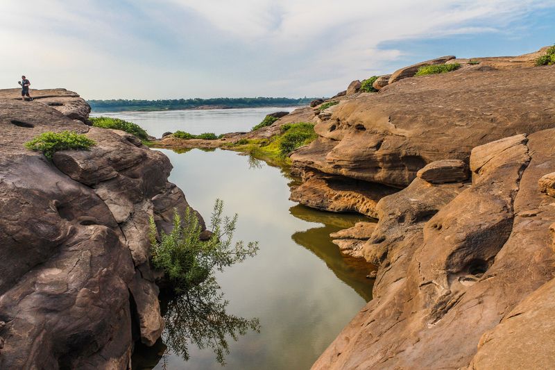 A Stream Flows Into a Lake in No. Arizona
Arizona rivers and lakes come in all sizes. The biggest rivers are defined a few ways. One method uses three factors to consider:3
- How many miles from river source to its mouth
- Square mileage of the river's watershed drainage area
- Average flow rate farthest downstream
For smaller Arizona rivers, we have to think about consistent water flow coursing through their riverbeds. And (a) and (c) above seem relevant analysis for this category.
For lesser streams, that may be some consideration also. Plus maybe a little common sense.
There is another factor for all types: is there enough flow to be able to create any lakes?
Let's try to figure out some groupings by various sizes and categories.
Biggest Arizona Rivers
Colorado River - This iconic river enters Arizona northeast of Page, about central to Arizona's northern border. Where the river enters the southern extremities of Lake Powell.
- Flowing generally southwesterly, through extraordinary features like the Marble & Grand Canyons.
- At Nevada's southern tip, Hoover dam created Lake Meade, & formed the states' border.
- This Arizona river leaves the lake, streaming south as the California border.
- More Arizona lakes there along its southerly run: Mojave, Goose Lake, Lake Havasu, etc.
- Until south of Yuma, it exits Arizona, into Mexico.
- All along the way, a resource for southwest towns & cities.
- For farming needs, recreation & drinking water - that means survival!
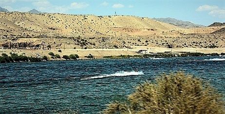 The Colorado River Along its Border With California
Salt River - Originally Rio Salado, called that by Spanish explorer Father Kino.
- Headwaters Area: Mt. Baldy2 in the White Mountains.
- Becomes the Salt after confluence of the White River & the Black River, south of Fort Apache. From there to Phoenix where it joins the Gila River, is about 200 miles.
- Averaging a downhill trajectory steeper than the Colorado. Especially from its beginnings until getting to Roosevelt Lake, it drops about 25 ft./mile.2 That makes for some quick flow & rapids!
- Further downstream are Apache Lake, Canyon Lake & Saguaro Lake.
- You can easily glimpse this Arizona river's spectacular canyon from Hwy. 77/60. A couple of overlooks for stopping.
- Every time we take this route & go through the Salt River Canyon, we've gotta stop for the view! Reminds you of a mini Grand Canyon.
 Just One View of the Salt River Canyon, From an Overlook on the River's South Side
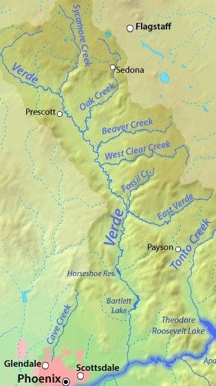
Verde River - Near Payson the E. Verde begins its prime tributary feed to the Verde. Other tributaries include Sycamore, Oak, Beaver Creeks & W. Clear Creek.
But the secluded, kind-of "exclusive" (you must reserve your trip!) Fossil Creek is maybe the most captivating.
This officially named wild and scenic Arizona river doesn't impound lakes until nearing its end. Those are Horseshoe & Bartlett Lakes.
- Easy river access at Dead Horse State Park in Cottonwood. Recreation suitable for tubing, boating, swimming, fishing, camping.
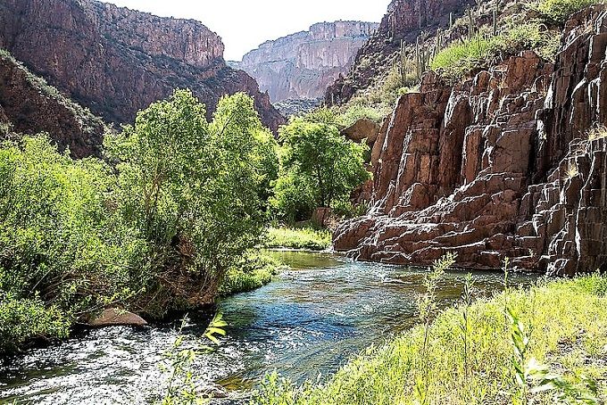
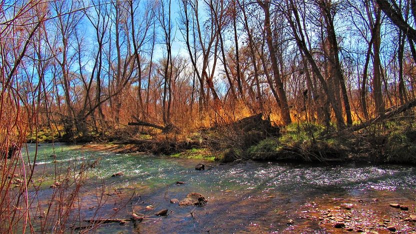 The Verde River Flowing Through Woodlands in Dead Horse State Park
Gila River - Places 9th of largest U.S. rivers, 642 miles until merging with the Colorado River.3
Overall, think of it as two rivers in one. Its Upper Basin is gorgeous, a beautiful place! It flows through forested hills & mountains, and canyon-like areas amidst deserts.
On the Gila, you can go rafting & kayaking, find back-country camping spots, & there's a section designated as a National Riparian Conservation Area.
All are wonderful visits upstream on the Gila.
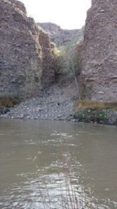 Flowing in Gila Box NCA
 Our Daughter Shannon at the Gila River
Its Lower Basin is mostly dry. What separates the two is the Phoenix metro area. Water needs create canal outlets & diversion dams. Painted Rocks Reservoir west of Gila Bend is one result.
Important Small Arizona Rivers
Little Colorado River - Tributary of the "Big" Colorado, averages 370 cu.ft/sec. flow. Summer & winter storms bring torrential surges.4 Otherwise coloring is a vivid baby blue! Flowing downstream 107 miles from its White Mountain source.5
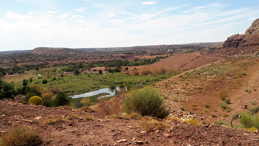 Little Colorado River Outflow From the Dam Creating Lyman Lake
Silver Creek - Average flow is 7 cu.ft/sec., northeast of Show Low. Upstream is White Mountain Lake.
- A small dam created the originally called Daggs Reservoir. Adjacent is Mexican Lake.
- Thing is these lake waters are "reserved exclusively for District Members and their authorized guests." In other words: property owners, because their taxes cover Its Use.
All a tributary of the Little Colorado, which has public lakes in its course.
That includes Lyman Lake...
 Lyman Lake
Created from Little Colorado River Waters
Lyman Lake - Formed from damming waters of the Little Colorado River. Enter the state park to enjoy all its recreation. A wonderful trip for swimming, relaxing, hiking, etc.!
Continue Along the Little Colorado
One of Arizona's Rivers Creating Lakes!
River Reservoir - Moving south, you'll find this lake next. It's the biggest of the 3 Greer Lakes. Fabulous fishing & camping there.
Lee Valley Lake - When finally arriving at the Little Colorado's East Fork's end.
- Enjoy nice non-motorized boating serenity here.
- Fish for stocked Apache trout & Arctic Grayling.
- Ahhh, the refreshing coolness of Apache-Sitgreaves National Forest, near Mt. Baldy.
- (Not for the winter!)
- Get There: From Springerville take AZ260W, then AZ273S, right onto 113E/Lee Valley.
Arizona Streams
Consistently flowing streams in Arizona are valuable tributaries to larger and smaller Arizona rivers. Very few create lakes, but certainly their flow can end up there. Their waters are so helpful to Arizona's flowing rivers, which of course along their way form lakes. What are the notable Arizona streams?
Carnero Creek - Smaller White Mountain stream, not a tributary to any Arizona river. Primary source is Carnero Spring, plus two others nearby.
All this enables creation of Carnero Lake, a small basin good for trout fishing. Limit is 2.
- Get There: From Eager, AZ260W, about 15 mi. right on FR117. Right on Fs117A. Then right on 2nd unnamed road & on another unnamed, to lake.
Show Low Creek - Beginning as Porter Creek out of Scott Reservoir, adds 1.4 cu.ft/sec mean flow to Show Low Lake. After that, egress through its bed into Silver Creek, then outlets at Little Colorado River.
Chevelon Creek - Adding 4 cu.ft/sec average after flowing from Woods Canyon Creek at Willow Springs Canyon. Then adding flow to Chevelon Canyon Lake, near Winslow.
- Great view on McLaws Road bridge.
Granite Creek - Sourced near Wolverton Mountain near Prescott. Parallels Hwy. 89 awhile.
Then into Watson Lake. Exiting there, flow measured at Granite Dells averages 1.06 cu.ft/sec.
Downstream confluence with the Verde River.
Oak Creek - Beautiful canyon & red rock areas for an awesome resource.
Headwaters in Pumphouse Wash meadows south of Flagstaff.
Finally merging with Verde River it normally has 72/+ cu.ft/sec. disgorge. Sedona is a prime area to see its waters.
 Oak Creek Slowly Flowing Through a Northern Part of the Canyon in the Summer
Beaver Creek - Wet, as opposed to Dry!
Averaging flow into Verde River at Camp Verde, of 7.6/+ cu.ft/sec. Headwater at 6500' in Coconino National Forest.
West Clear Creek - Headwaters west of Mahan Mountain, before Arizona National Scenic Trail.
Merging with Verde River, SE of Camp Verde. By then averaging 19 cu.ft/sec.
Parker Creek - Headwaters SW of Carr Peak in Tonto National Forest. Upsteam flow averages 40 gal./min.
Downstream becomes Cottonwood Wash, exiting into Roosevelt Lake.
Tonto Creek - Headwaters in Sitgreaves National Forest, flowing through Hellsgate Wilderness & Tonto National Forest. Through frequent canyons.
- There's 22 cu.ft/sec. of average flow when arriving into Roosevelt Lake.
Aravaipa Creek - Sourced near 4500' in Galiuro Wilderness. Gurgling slowly downhill to Aravaipa Canyon Wilderness, through/by scenic canyons & trails.
Wends its way out to Hwy.70 north of Tucson, above Mammoth, westward into the San Pedro.
- By then often dry.
- After Wilderness ends, mean output: 17 cu.ft/sec.
Cave Creek - Upstream beginnings West of Blackjack Point/Cooks Mesa. Flow averages 0.49 cu.ft/sec.
Downstream enters the Arizona Canal in Phoenix.
Blue River - Sourced from Campbell Blue Creek, at about 8000' in Apache National Forest. Coleman, Castle & Turkey Creeks merge.
Then below Mother Hubbard Canyon it becomes the Blue.
Several tributaries: Grant & KP, & more. Output averages 13 cu.ft/sec., merging with the San Francisco River.
San Francisco River - Headwaters around 9000' into Apache National Forest. Flowing East into New Mexico, picks up Tularosa River waters.
Winds back into AZ, & the Blue River converges. Turns south through Clifton, at 2 cu.ft/sec., finally entering the Gila.
Bonita Creek - Headwaters about 6400' elevation, then through San Carlos Reservation, until joining Gila River with 4 cu.ft/sec. mean flow.
San Carlos River - Headwater at Ash Creek.
Called San Carlos after confluence with Natanes Creek. Elevations 4600' down to 4300' as it often forms Graham/Gila county border.
US Hwy.70 outflow averages 12 cu.ft/sec. Then intermittently drying up with farming, & desert terrain.
Agua Fria River - Headwaters about 5200' elevation south of Hwy. 89A northeast of Prescott. Gurgling past Prescott Valley, then east of Dewey-Humboldt, under I-17 east of Cordes.
Then through Agua Fria National Monument, Black Canyon City & returning west of I-17. Volume throughout: 7 cu.ft/sec.
- Intermittent flow afterward into Lake Pleasant.
Babocomari River - Old West history there, with Tombstone Cowboys from the OK Corral.
Headwaters about 5000' up, behind Elgin Elementary School.
Runs eastward, through Elgin's center, eventually under Hwy.90 in Huachuca City. By then a trickle, if that (probably dry).
Continues toward Fairbank, there linking into the San Pedro south of Hwy.80.
- Total percolation averages just over 433.5 gal/min.
Salt River Tributaries - All emitting upstream flow:
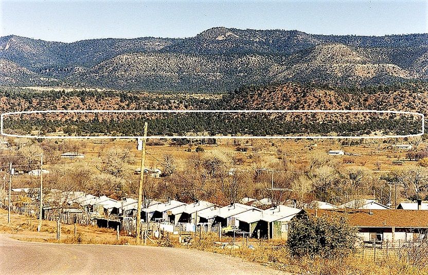
Cibecue Creek - From the Apache language meaning reddish bottom land. An Apache Village was located creekside in the 1800s.
Medicine Man Nokay Delklinne was there leading the Coyotero Band in the Ghost Dance. The military arrested him August 31, 1881, leading to rebellion by Apache Scouts. Battle resulted in 11 military deaths, 47 Apaches imprisoned (2 at Alcatraz), 3 hanged.6
About 15-20 feet wide, with meadow & brushy banks, with canyon areas.7 Headwaters west of Rt.34, south of White Spring. It still runs through Apache lands southward, until confluence with the Salt.
Carrizo Creek - The name comes from Spanish, for cattails. Named for those growing along the banks in some areas.6
Upstream source is Corduroy Creek, not far from Hwy.60 Cedar Canyon bridge.
Cherry Creek - Two springs source headwaters near Young AZ.
From Globe, take AZ188, then right on AZ288 (Globe-Young Hwy.), into Young, where it turns right, continue. When beginning left curve, instead make right on Cherry Creek Rd. (Nf54).
You'll travel spectacular vistas, including a short trek from desert to forest.7
Pinal Creek - With its own upstream canyons & wildlife including beaver, it can be an adventure to see!8
- Downstream, located near mining, ADEQ had to remediate its waters.
Pinto Creek - Headwaters near 6000' southwest of Madera Peak.
When reaching Miami area, flow averages 1.47 cu.ft/sec. Soon after streambed to Salt trickles or dry, except in storms.
The New Pinto Creek Bridge is Now in Place
Verde River Tributaries - Check the Verde River Map to see them. But below we list some interesting ones:
Wet Bottom Creek - Named by cowboys crossing their cattle, sinking up to their "butts." Of course they actually called it Wet Ass Creek!6
Headwaters about 6000' in Mazatzal Wilderness. Reaching Maricopa County, flows nearly 394 gal./min. Soon after trickling to near/at nothing.
Sycamore Creek - Apache battle here in 1872. Then named Raccoon Creek by K.S. Woosey. George Cline lived here in 1886, stating he knew it as Sycamore. But locals called it after him.6
Headwaters east of Mt. Peely near the Maricopa/Gila County line. Upstream flow mean near 247 gal./min.
Joins the Verde inside the Fort McDowell Yavapai Nation.
East Verde River - Initial upstream source. Which has its own gurgling tributaries: Dude Creek & Ellison Creek.
All of these have well liked fly fishing spots.7
More Important Arizona Streams
Sabino Creek - Flows out from the 8300' source north of Summerhaven on Mt. Lemmon in Tucson's Santa Catalina Mountains.
A wonderful city respite, as it tumbles down just over 934 gal/min. refreshment.
Once hitting the desert floor, it soon dries up as it enters the dry Rillito River, a tributary of the Santa Cruz River. (Except during Monsoon Season storms!)
In Sabino Canyon Recreation Area, hike to Sabino Creek Dam, forming Sabino Lake.
Cienega Creek - From its source about 5500' up in the Santa Rita Mountains, south of Tucson, it rolls northward downhill. Traverses Hwy.82 east of Sonoita, further into the grasslands of Las Cienegas National Conservation Area & Empire Ranch.
Outflow close to 321-1/2 gal./min. It runs under I-10 east of Vail & crosses the Arizona National Scenic Trail.
Joins with Tucson's Pantano Wash, where the flow levels to 306 gal./min.
- Soon after dries in the Sonoran Desert, then to the Rillito River, finally the Santa Cruz.
Webber Creek2 - Lots of pooling in this small waterway. Runs very slow with lack of rain. About 10-12' wide when flowing well.
Some trout fishing here!
- Find It: Hwy. 87 North of Payson, East on 64/Control Rd.
See References For Arizona Rivers and Lakes>
Some Directional Information on This Page May be sourced from Map data ©Google
All River Flow Data from Arizona Water Science Center at waterdata.usgs.gov1

