Arizona Lakes and Rivers
Arizona lakes and rivers are a wonderful resource. Throughout this desert state, we have water fun ideas for you. Water is a precious resource here. In the Southwest we value it greatly.
We roam our state every chance we get to live that life, ourselves! We love it!
So why not share?
Arizona Lakes and Rivers
Have Cool Stuff to Do
 Bald Eagles Can Be Seen on Arizona Lakes and Rivers
Every Southwestern state has towns and cities with their own local parks. For us much of the time, they're often centered around Arizona lakes and rivers. Because we live in Arizona! So it's easiest for us to visit them.
We love going to these places, because of the scenery, the majesty, the enjoyment, the enhancement of our well-being. And because we find lots of things to do to have fun. Which have we found in Arizona? Quite a few. And where?
Arizona Local Lakes & Rivers
Two main interstates traverse the state, three others are major connectors.
Although Phoenix is a large sprawling city, suburbs provide nice local park lakes. Tucson also has great things to do locally at lakes and riversides. Flagstaff & Yuma are other larger cities. Can we find anything there?
With purchases made via links on our site, we may earn a small commission at no extra cost to you. Details at our Advertising Policy.
Let's take a virtual road trip through our state (by scanning on down the page) looking for Arizona lakes and rivers. Or, if you know where you'd directly plan to go,
JUST CLICK IT BELOW:
Tucson Arizona Lakes and Rivers
Tucson Lakes
Crossing southern Arizona on Interstate 10, here are some great Lakes in Tucson.1
Reid Park - Exit 22nd St., head East. 1-1/2 miles on left, enter at Lakeshore Dr. for parking. Straight ahead are two lakes.
Over 156 acres, with tons to do around the lakes. A playground at either end of the lake. Rose garden adjacent. Plus much more Throughout the Park.
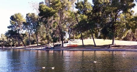 One Area of One Lake in Reid Park
Christopher Columbus Park - Open 6am-10:30pm. Off I-10 Exit 252 onto El Camino Del Cerro, then left onto Silverbell to entrance on left.
- Two lakes: small Archer Lake & larger 13 acre Silverbell Lake with dock. Think boating & fishing!
- Comfortable stop for water fountains & restrooms, plus its Dog Park.
- Playground, benches, picnic tables & grills.
John F.Kennedy Park - On Ajo Way (Hwy. 86), corner of Mission Rd. Accessed via I-10 or I-19. Easiest lakeside access is from S.La Cholla Blvd., which is off Ajo. If you're just traveling through Tucson, it's the least convenient freeway traveling stop.
- With an excellent fishing Lake. Also playgrounds, basketball & tennis courts. Plus picnic tables, ramadas, benches & drinking water.
Sweetwater Wetlands Park5,6 - Using reclaimed water this tertiary system recycles it for wetland habitat, encouraging birdlife and more! Multiple ponds with encircling trails/paths, edged with cattails, willows & cottonwood. What a fantastic place to see wildlife. What else?
- Hours: dawn til 1-hour post-dusk, when gate's locked! Monday only: Opens 9am.
- No bicycles, dogs, horses.
- For kids, make it a fun Learning Experience>
- Take "The Loop" bike path to the West Entrance along the Santa Cruz River. Park in the bike-rack, rest up on the bench, throw out your trash & come on in.
- Or access it from the I-10 west-side frontage road, turning south off El Camino Del Cerro/Ruthrauf.
Tucson Rivers (7)
Santa Cruz River Park - The Santa Cruz river has a small part that runs, associated with the Sweetwater Wetlands. Elsewhere through Tucson it's dry, except during strong Monsoon Storm events. Then it roars down that streambed! What To Do though?
Along its banks find "The Huckelberry Loop" - what? This entire loop system is a shared pathway throughout the city. Walk it, ride bicycles, skate it, even for equestrians.
Keep these things in mind (be sure to know all the rules!):
- No motorized vehicles, except ADA accessible
- Open dawn to dusk
- Stay right, pass left; no high-speeds; on/off only at authorized access points -
- No alcohol, camping, fires, littering
- Leash all pets (<6 ft. long), keep under control. Horses: well trail-trained
- AND - A Disc Golf Course is here: Take I-10 Exit 57, West on Speedway. After School for Deaf and Blind turn right on Riverview Blvd. for right into Santa Cruz Park.
Cañada del Oro Christina-Taylor Green Memorial River Park - Alongside the regularly dry Cañada del Oro River, or wash, as it's often locally termed. The Loop also runs along here. Christina's name was added to honor her life. Sadly a gun violence victim on January 8, 2011, at Congresswoman Gabrielle Giffords' event in Tucson.
- Enjoy the desert memorial park with its butterfly garden
- Comforts include drinking water & restrooms
- River alongside runs in Monsoon Storms. Like here, with Bighorn Fire (2020) debris from the Catalina Mountains
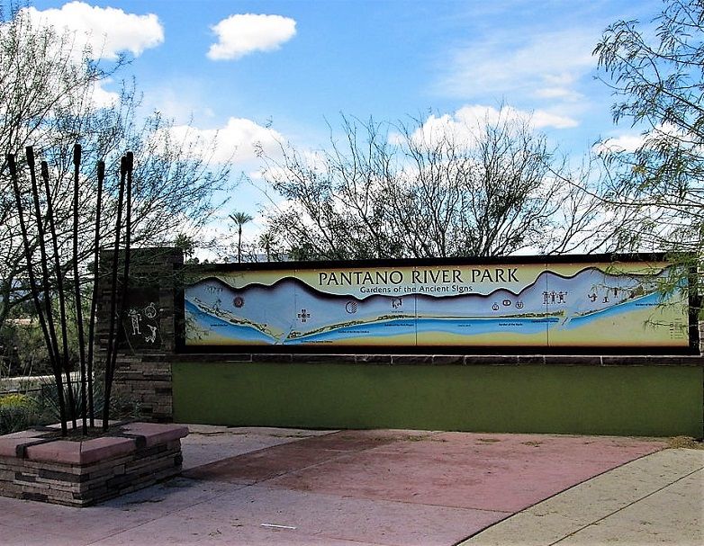
Pantano River Park - Another dry river, quickly running with monsoon storms. Also alongside the Loop, with drinking water & restroom comfort zone. A memorial park section is lined with trees with explanatory signs. Also unique here is the Children's Memorial site at Michael Perry Park. Remembrance for a 12-year old kidnapped/murdered.
A Wall has children's engravings, aiding a local nonprofit.
Phoenix & Suburbs - Lakes & Rivers
Phoenix Area Lakes (2,3,4)
Desert Breeze Park - Chandler, I-10 Exit 160 to W.Chandler Blvd., left at N.Rural Rd., right on Desert Breeze Blvd to park.
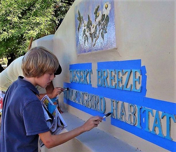
Lakeside picnicking, rest rooms, playground, spray/splash pads, trails. Fun train ride is open on weekends/holidays. Don't miss the Hummingbird Habitat!
Cortez Lake Park - Where to give the kids a break on your Arizona trip? North end of Phoenix, a shady place lakeside, with a fun playground.
- Exit 207 off I-17, Dunlap Ave. West. Exit 141 off I-10, take N. 35th Ave. North, cross under 60. On til passing Dunlap.
Kiwanis Lake Park - Tempe, I-10 Exit 155 onto W.Baseline Rd. Go East, entrance right after canal.
- Picnic tables, ramadas, restroom, playground.
Dobson Ranch Park - Mesa, I-10 Exit 157 to W. Elliot Rd., over Hwy. 101, left onto Dobson Rd.
- Right for Mesa Library parking, then left for Park parking. Sunrise to 10pm.
- Enormous playground with experiences for all children, of all ages. From zip lines to music play, to assorted good ole swings.
- Shaded picnic tables, grills, restrooms.
- Basketketball courts, trails, & of course the lake.
Friendship Park - Avondale, a very nice town West of Phoenix. I-10 Exit 131, North on Avondale Blvd., left on W.McDowell to park's left entrance.
- Excellent family visit with Japanese Garden, Dog Park, Splash pad, trails.
- Friendship Pond for fishing, sports fields/courts, playground, picnicking.
- What more could you ask??
Phoenix Area Rivers
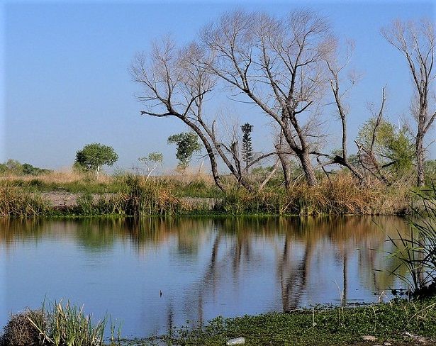
Tres Rio Wetlands - A gem in the desert, aside the dry Salt River.
Recycling wastewater for rehabilitating this riparian habitat. As it was in the 1800s. This oasis attracts over 150 varieties of animals, including many birds that aficionados love locating.
- Free to enter, but you must Have A Permit. Good for multiple entries over six months, sunrise to sunset.
- Plan for NO: restrooms, drinking water, garbage bins, or maintained trails
- From I-10, use 91st Ave. Exit, turn South, drive 5 miles passing Broadway Rd., then 1 mile to driveway on Right. No lot, limited parking along driveway.
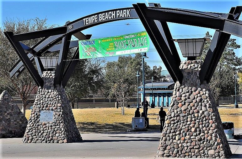
Tempe Beach Park - Parking off Rio Salado Parkway. Alongside what's called Tempe Town Lake. But really it's the reconfigured Salt River, dry when nearing Phoenix.
- Hours 5am til midnight.
- So much to do! 5 miles of trails/paths, picnicking, sports fields, fishing & boating (rentals available).
- Also Tempe Center for the Arts. Any further details: 480-350-5200.
Flagstaff Arizona Lakes and Rivers
Flagstaff Lakes (5)
Pumphouse County Natural Area - South of I-40, I-17 Exit 333, Mountainaire Rd., go West, immediate right onto Tovar Trail.
- Park at adjacent Raymond County Park, where you'll find benches, picnic tables, playground & restrooms.
- Pumphouse's small spring-fed lake is the headwater for scenic Oak Creek.
- A short round-trip trail has wildlife viewing spots, benches & instructive placards
Kachina Wetlands Preserve - Use Pumphouse directions, but on Tovar continue uphill, to corner of Lohali Trail parking at roadside.
- Behind signed area, dirt roadways through wetlands. Nice stop to stretch your legs, see birds, nice views.
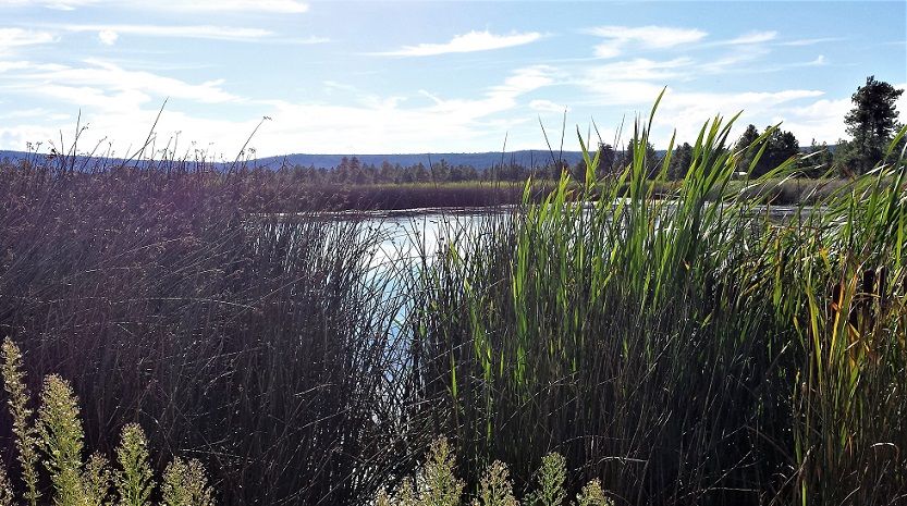 Kachina Wetlands' Lakes Attracts Tons of Bird Life
You Can Imagine Why! What An Oasis!!
Flagstaff Rivers
Rio de Flag - The one natural river in this small, but growing historic mountain city.
- A Nonprofit has become its friend. Because over the years, it's had some rough times.
- Foxglenn Park takes you to the Foxglenn Trail following the canyon bottom of the Rio de Flag.
Yuma Arizona Lakes and Rivers
Yuma Lakes
West Wetlands Park - Located at 282 N. 12th Avenue. Wonderfully planned for a variety of things to do. So that the entire family can have a great time there, enjoying activities. This is the complete Arizona lakes and rivers park!
- There's Disc Golf, Trails for hiking, Picnic Facilities with ramadas, fishing.
- Plus a wonderful Creative Playground with a castle, etc. You've got to see it, 'cause if you have little ones, they're gonna love it!
- See their Solar Demo, & the Butterfly & Hummingbird Gardens!
- Sit on the bench to try spotting a Burrowing Owl in the native trees/grasslands natural area. They've prepared burrowing areas just for them!
- And the lake! Yes, it's stocked for fishing, with your Arizona license.
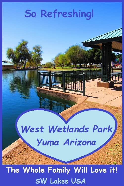
- With A River - You can also take a boat over to the boat launch onto the Colorado River. There's a river beach adjacent, too.
Yuma Rivers
The Gila River's confluence with the Colorado River is here, but we don't recommend seeking it out. The Gila is dry, roads to it so sandy you could get stuck, normally evidence of pop-up unauthorized camping, plus possible private-property.
Just not worth it! But the Colorado River is another story!
Centennial Beach - From West Wetlands Park, entrance from N. 12th Avenue, enter roundabout to W.Water St., take 1st right to parking & beach path.
- Access the Colorado River via the boat ramp. Wade into the water at its beach!
Gateway Park - 1st St. & Gila. Fish the Colorado from docks.
- Take I-10 Exit 1, left at E.8th. Follow curve onto Giss Parkway, then 1st roundabout exit, all the way on N.Madison, to parking right after railway tracks.
Riverside Park - Adjacent to the Colorado. Picnicking, but no specific river amenities.
- What's cool is the mini railroad. Ride 3,000' down the track. Yuma Territory Live Steamers have public rides 2nd & 4th Sat./Sun. Oct.-May, 10am-3pm.
- Alongside is East Westlands Park to get better Colorado River access, plus wonderful birding.
- Also near is historic Yuma Territorial Prison.
- I-10 Exit 1 left on 8th, right on Prison Hill Rd., right on S.Levee Rd.
Bullhead City Arizona Lakes and Rivers
Location on the Colorado River means this small town has terrific Arizona river recreation.
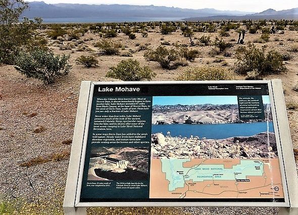
LAKES: With the town's abundant riverside frontage, they didn't much bother creating lakes. In this desert, no natural lakes either. But upriver, just over 2 miles as the kayak paddles, is Davis Dam, which created Lake Mohave.
Bullhead City Rivers
It's all about the Colorado River!
Colorado River Nature Center - This cooperative effort with Arizona Game & Fish, BLM, & Bullhead City has many options. Day usage on 500 acres.
- You'll find 8 trails with illustrative signs. Plus nature observation benches, decks, boardwalks & shaded ramadas.
- Cool off at Rio Lomas Beach, or go fishing.
- Picnic facilities, fire pit, restrooms, fish-cleaning station
- Dogs should be leashed. Use caution regarding rattlesnakes
- Get there about 7 miles South of the City on Hwy. 95, right onto Richardo Avenue.
Dean Hackett Park - Small park donated to the city by local home-owners. At 1051 Terrace Drive.
- Has a playground, picnicking resources, & boat launch.
Rotary Park - 300 Acres means lots of stuff for fun. But beware of this: Non-residents, March-Oct. & Holiday weekends, pay $20 Day-Use Parking Fee here.
- Multiple sports fields & courts, disc-golf, radio-control aircraft flying, horseshoe pits
- Over 1-mile of beach, fishing pier/ada suitable, fish-cleaning station
- 4-lane boat launch with wipe-down area - Fee charged depending on combination of residency/ age/ timing: $8 up to $75.
- Dog park, 3.2 miles trails, skate park.
- Amphitheater/fire-pit.
Bullhead Community Park - 376 acres of excellent action! Also has Parking Fee as with Rotary above.
- Picnicking, sports fields, playground
- Almost 1-mile of Beach, protected swimming area. Boat Launch, Fish-Cleaning Stations
- Dog Park, horseshoe pit
- And lots of local historic features:
Navajo Nation Lakes and Rivers
The Navajo Nation, their people's lands (read: reservation) covers the Northeast part of Arizona, and goes into New Mexico. Anything there is overseen by Navajo laws, for instance camping, fishing/boating Licenses, etc.
Two lakes near the NM border may be of interest.
Wheatfields Lake11 - Accessed from I-40 Exit 357, North on Indian Rt. 12, at Hwy. 264 make right, at Windowrock make left, again onto Indian Rt. 12. Up the road bear right keeping on 12. It'll wind through NM for a bit while traveling North. When finally crossing into AZ, crossing Whiskey Creek (likely dry), not much farther now!
- On the right you'll spot the 7000'+ elevation lake, then turn to the Wheatfield Lakeside Convenience Store. They've got bait & supplies. Navajo fishing license required. Good to be familiar with Navajo boating/fishing laws.
- Near-by the Chuska Mountains (elevations up to near 10,000'), these bottom lands are fed by its mountain streams:
Tsaile Lake - Closer to populated area, near Diné College's main campus in Tsaile. With not so much isolation, not so pristine either.
Not the water, but the surroundings. Nearby areas have specified campgrounds, but dispersed, without many amenities.
- Tsaile Lake Campground, Black Pinnacle Campground, South Shore Campground.
- Directions: From Wheatfields Lake, continue North on Rt. 12. There's a 1st option: left turn to South Shore CG. Or continue through roadway curve, pass intersection with Road C443, pass church on left & James Rd. Take next of several lefts to Tsaile Lake and/or Black Pinnacle Campgrounds. All get you to Tsaile Lake & other lakeside roads.
As you can see there are so many Things To Do at Arizona's lakes and rivers. And that's not all! Because there are...
Even More
Arizona Lakes and Rivers>
See References For Arizona Lakes and Rivers>
Some Directional Information on This Page May be sourced from Map data ©Google
